Blog

Community resilience work in rural Virginia through The RAFT featured in Envision Magazine

It is an honor to have the community-driven resilience work that my team and I have been leading at the University of Virginia (UVA)’s Institute for Engagement & Negotiation (IEN) in coastal Virginia featured in Envision Magazine. I have been working on The Resilience Adaptation Feasibility Tool (RAFT) as a project manager at IEN for the past three and a half years, and have found the work supporting communities to advance the resilience priorities that they set themselves to be long, slow, hard— and at times tedious— work, but the lasting impacts and testimonies from the people we serve in communities truly make my heart sing! If you are interested in learning more about The RAFT and our work in rural communities across Virginia you can check out our website here: https://raft.ien.virginia.edu/.

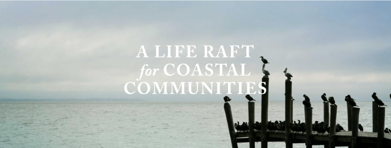
The rest of this post is text originally from the article, “A Life RAFT for Coastal Communities” recently featured in UVA’s Envision Magazine. Read the full story here.

Photo originally from UVA Envision story.

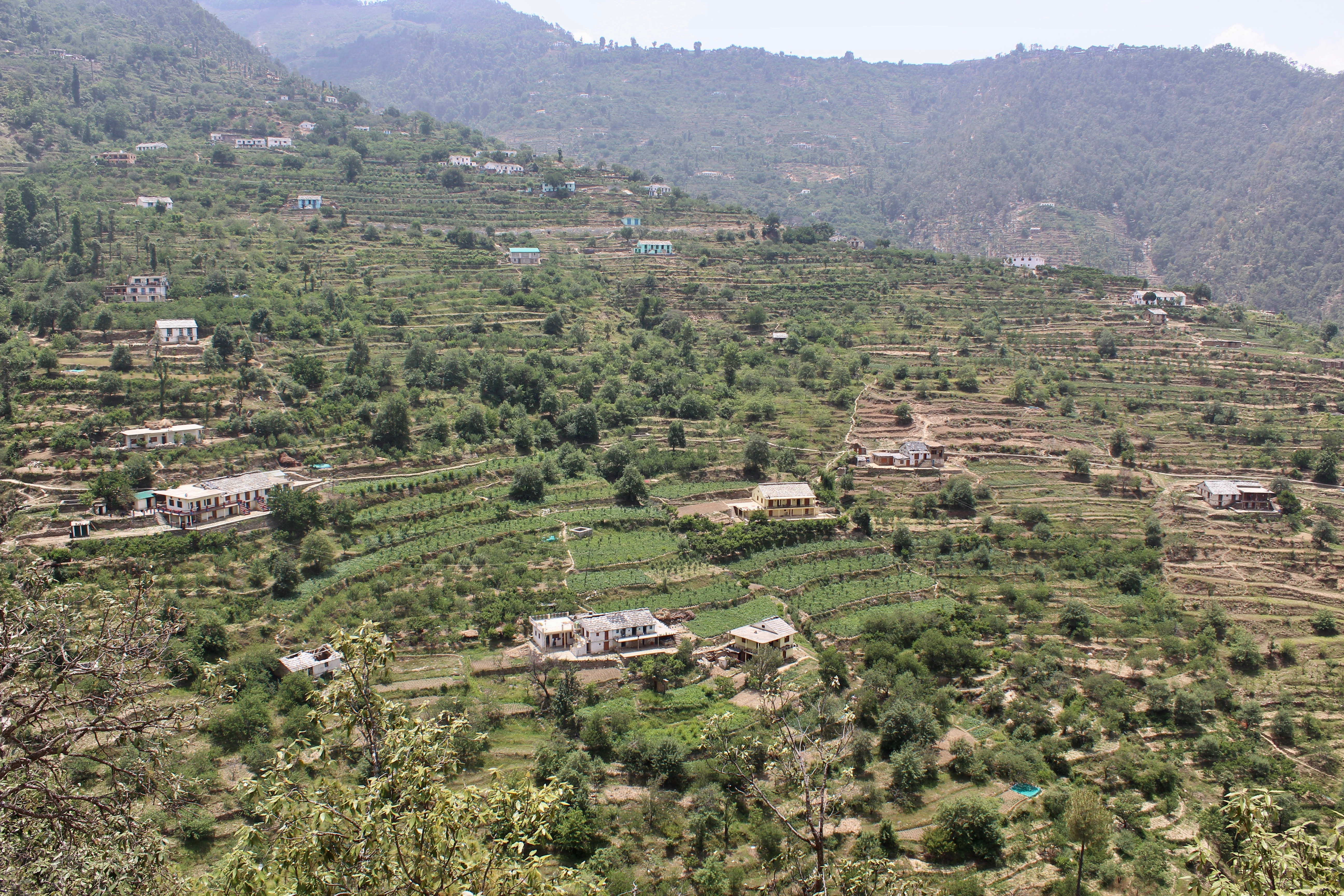
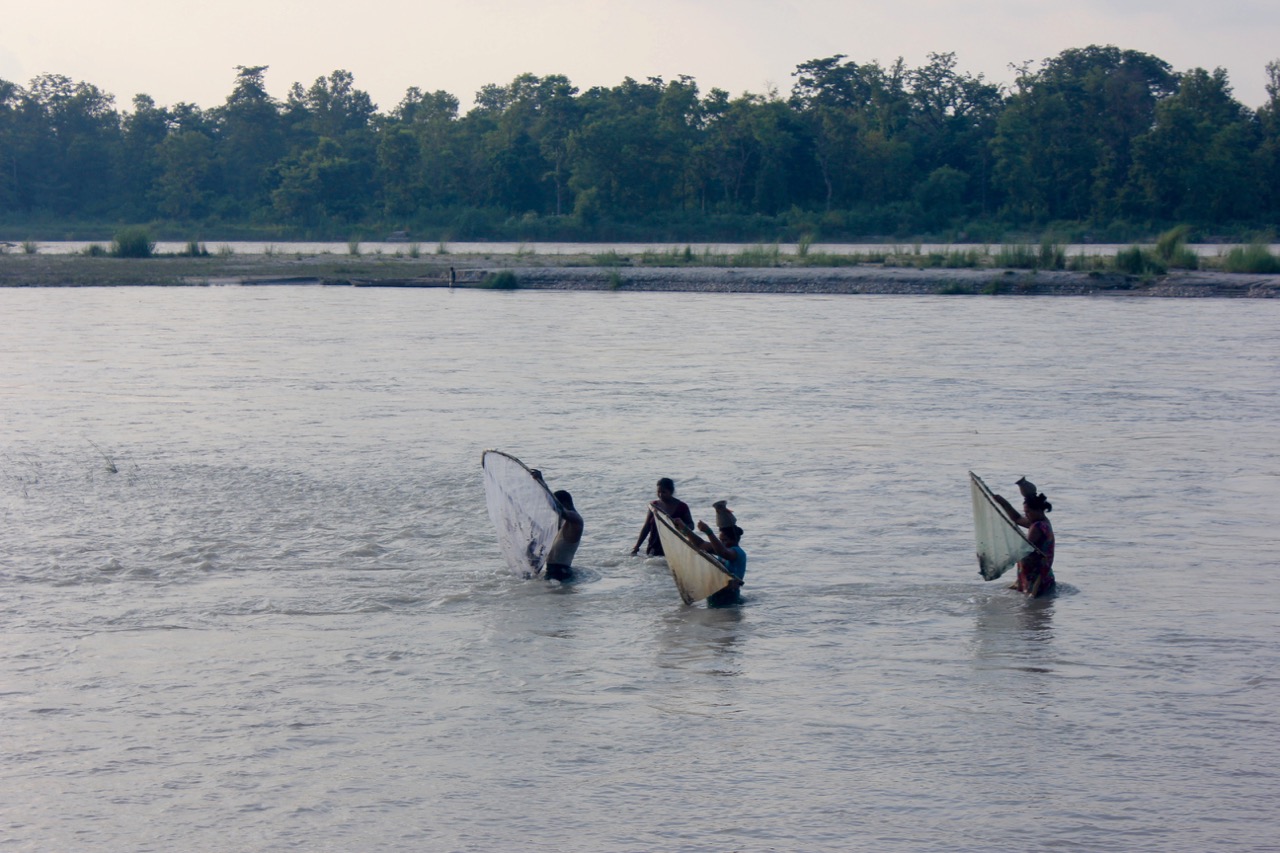
“Just downstream from a bend in the Potomac River, as it widens into the estuary that empties into the Chesapeake Bay, lies the small riverfront town of Colonial Beach, Virginia. Located on a side peninsula of a larger peninsula—known as the Northern Neck—water surrounds the community on three sides.

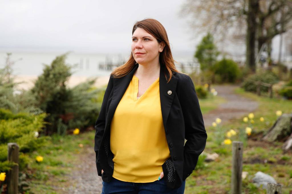
When Hurricane Isabel howled into Colonial Beach in September 2003, the winds toppled ancient oaks and destroyed the town’s marina and pier. The storm surge eroded miles of shoreline. Local resident Robin Schick (Arch ’08) was in high school then, but her experience during Isabel, and the rebuilding efforts that took place in the storm’s aftermath, led her to devote herself to a life of public service. It also taught her that a smart community must plan for a future where resiliency in the face of disaster becomes a part of everyday life. She knew that for her town to thrive, it must either adapt—or slowly wash away.

Photos of Mayor Schick originally published in UVA Envision Magazine.

That’s why Schick, mayor, Town of Colonial Beach, is incorporating something called The Resilience Adaptation Feasibility Tool (RAFT) into her town’s long-term strategic planning. The RAFT is an approach to climate resilience that was conceived and developed by the University of Virginia’s Institute for Engagement & Negotiation, the Virginia Coastal Policy Center at William & Mary Law School, and Old Dominion University’s Virginia Sea Grant Resilience Program. The RAFT leverages the expertise and resources of these academic partners to assist coastal localities that want to reduce their vulnerability to natural disasters. Its collaborative model helps these coastal towns to adopt policies and programs that improve resilience while also strengthening the social fabric that keeps their communities healthy.

Thanks in part to a major grant from the Jessie Ball duPont Fund, The RAFT has been able to expand from an initial pilot project in 2017 that concentrated on a city (Portsmouth), a county (Gloucester), and a town (Cape Charles) to encompass a more regional approach that includes coastal communities on the Eastern Shore, the Northern Neck, and the Middle Peninsula. In the process, the duPont Fund’s support has allowed The RAFT to broaden its scope from addressing storm hazards such as frequent flooding and sea level rise, to a focus on deep-seated economic and social challenges.

A Scorecard for Survival

Founded in 1980 as a public service organization in the School of Architecture, the Institute for Engagement & Negotiation’s breadth of work addresses issues that affect both the natural and built environment—natural resources, public health, community infrastructure, and equity and social issues. Taking a public service approach that integrates consensus-building, research, and teaching, the institute serves as an intermediary to help local governments, agencies, nonprofits, and businesses collaborate on decisions that sustain their communities.

Since many places in Virginia lack an easy way to define and measure resilience in an ecological, social, and economic sense, IEN leverages its expertise to fill in gaps in knowledge and communication so that decision-makers can draw from a complete toolbox when disaster strikes. It is what Tanya Denckla Cobb, IEN’s director, calls “equitable collaboration.”

“One of the things that’s unusual about our institute is that we have identified gaps, stepped into them, and created projects,” she said. “We have, over many decades, had a history of stepping into a space and saying, ‘We see a need here.’”

The RAFT is one such project. Its goal is to help Virginia’s coastal communities improve their resilience to flooding and other coastal storm hazards while retaining a healthy economic base and viable social networks. The 18-month process includes an independent assessment of a community’s resilience using The RAFT Scorecard; a community leadership workshop where participants discuss strengths and opportunities, developing a checklist of actions that can be completed and/or initiated within one year; and support by The RAFT’s collaborative universities and other partners through one year for the community’s implementation of these actions.

Crucially, for cash-strapped local governments, the three-part process is supported through a mix of federal, state, and private foundation grants and donated services, and is provided at no cost.

Sink or Swim

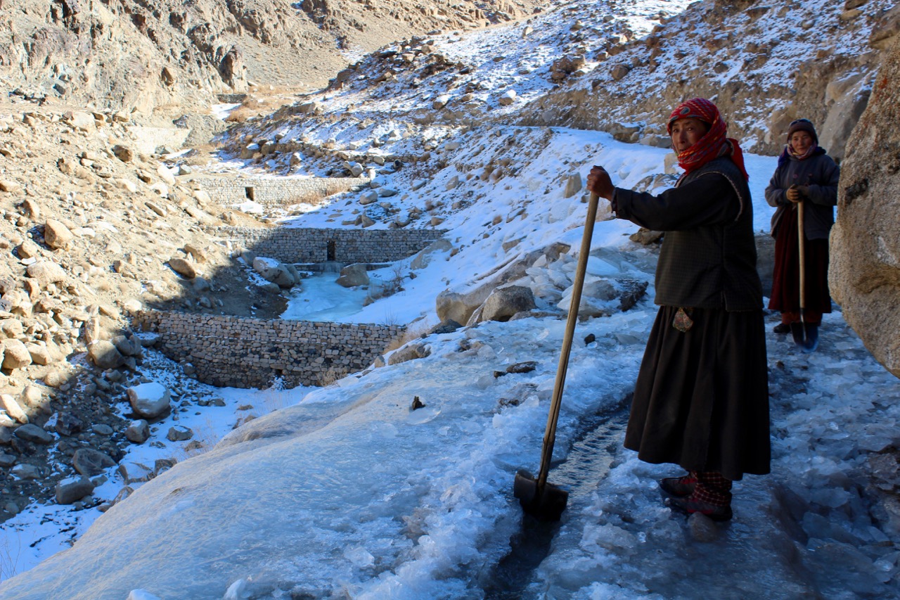
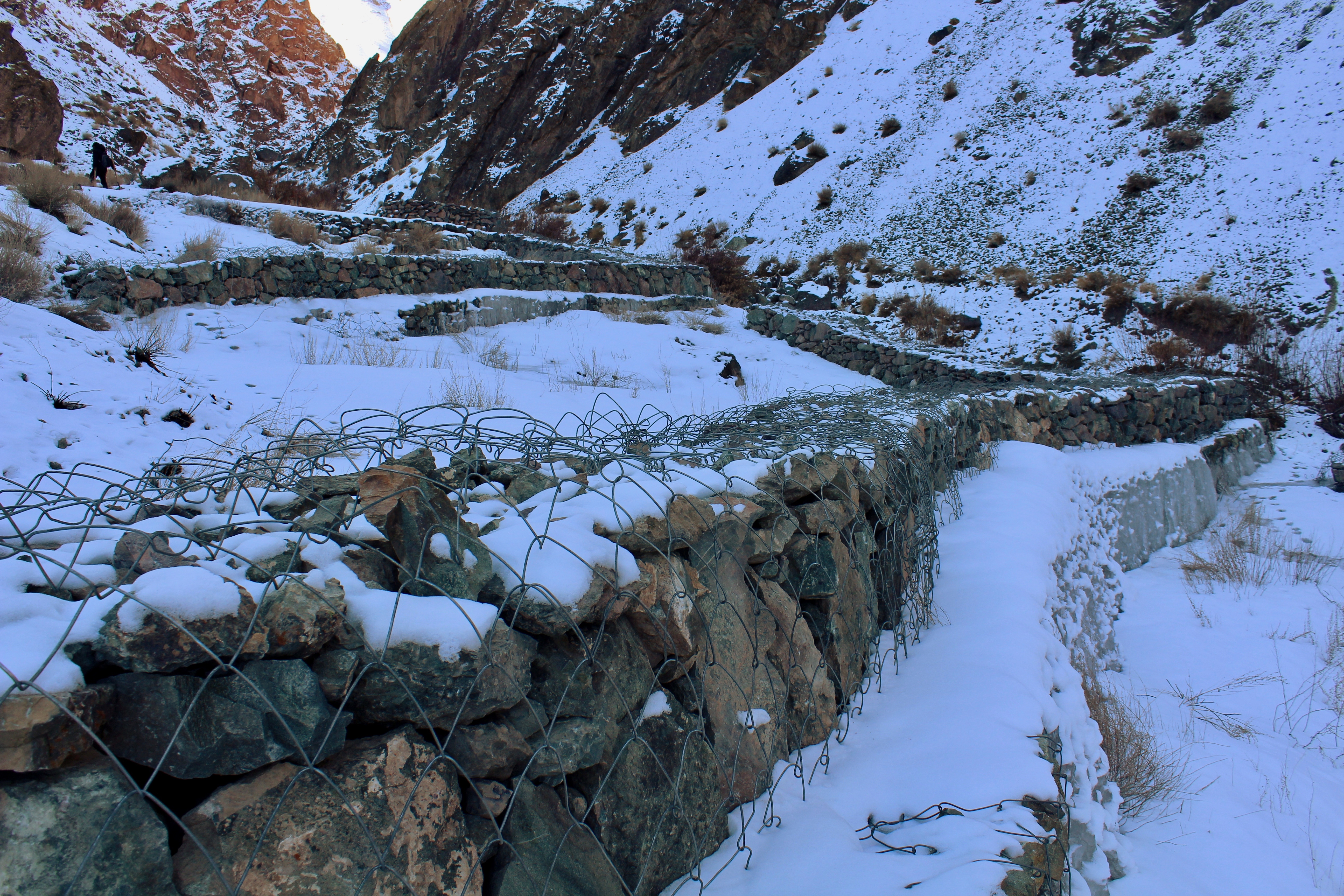
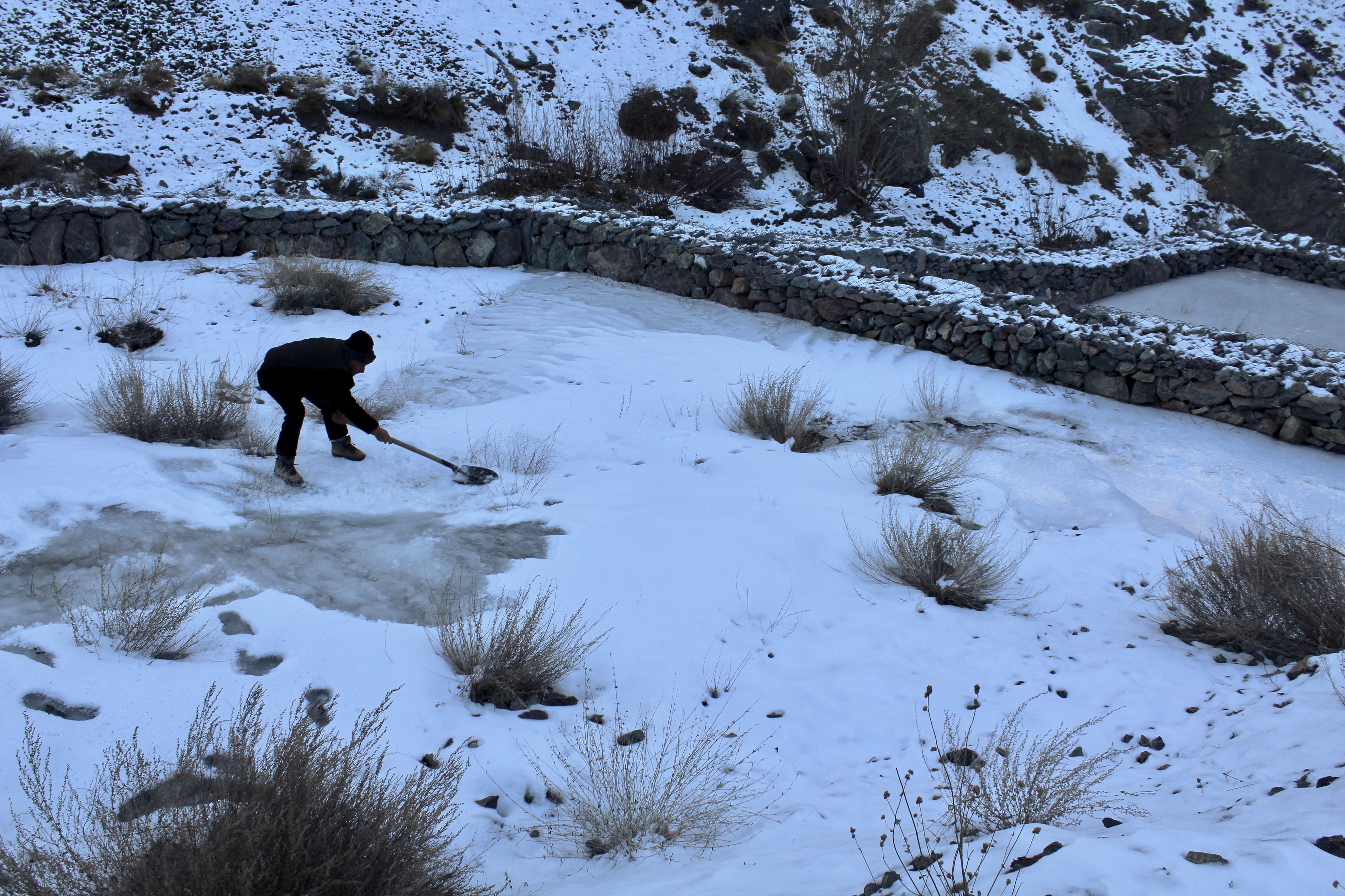
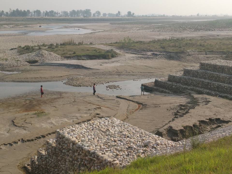
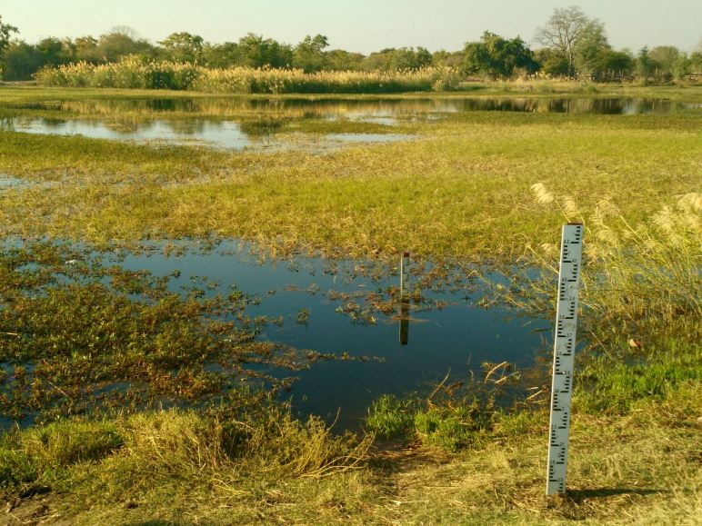
Local officials in Virginia’s coastal region face daunting challenges. Historical and projected sea level rise and the frequent flooding that results present coastal localities with challenges that affect residents, businesses, and public health services.

Colonial Beach has a year-round population of about 4,000, which doubles in the summer. It has the second largest public sand beach in the commonwealth. Schick said that The RAFT program piqued her interest because of its emphasis on resiliency.

“We have been at the forefront of participation in the program because it has such a direct correlation to the threats and needs we see in our community, and the challenges we’ve faced over the years, and will continue to confront,” she said.

Disaster can come from out of the blue.

“Last year, we had a tidal surge,” Schick said. “This was not a known storm event so it kind of took us by surprise. It was a nor’easter combined with a strong moon tide and a wind that was relentless for days. It did enough damage to our boardwalk and beachfront that our town pier was closed until recently. A significant number of docks and boats were damaged. We had pontoon boats sitting in the middle of the road.”

A few businesses closed because of the storm, victims of the double whammy of tidal surge and the ongoing COVID-19 pandemic. Prior to her election as mayor in 2020, Schick served on the planning commission for nearly a decade, and later, on town council.

“I saw a lot of advantages in working with The RAFT because these university research programs are the innovators of the next generation,” she said. “This program seemed to fit Colonial Beach. But also, I saw it as a way to preemptively align ourselves with whatever funding or solution was going to come out of the state, because eventually that’s going to have to happen. Resiliency is something that all communities across the seaboard are facing, even inland communities.”

Vicki Luna currently serves on the Colonial Beach Planning Commission. She’s also a proponent of The RAFT. “It helped to direct our attention to resources that we might not have otherwise been aware of and put us in touch with some of the key agencies in the state,” she said. “Working with The RAFT team helped us to qualify for grant opportunities. The essential one that we’re looking at now is the Community Preparedness Flood Fund. That has been a real saving grace for us because we’re going to be able to leverage a lot more resources in our small community.”

Not Just Fair-Weather Friends

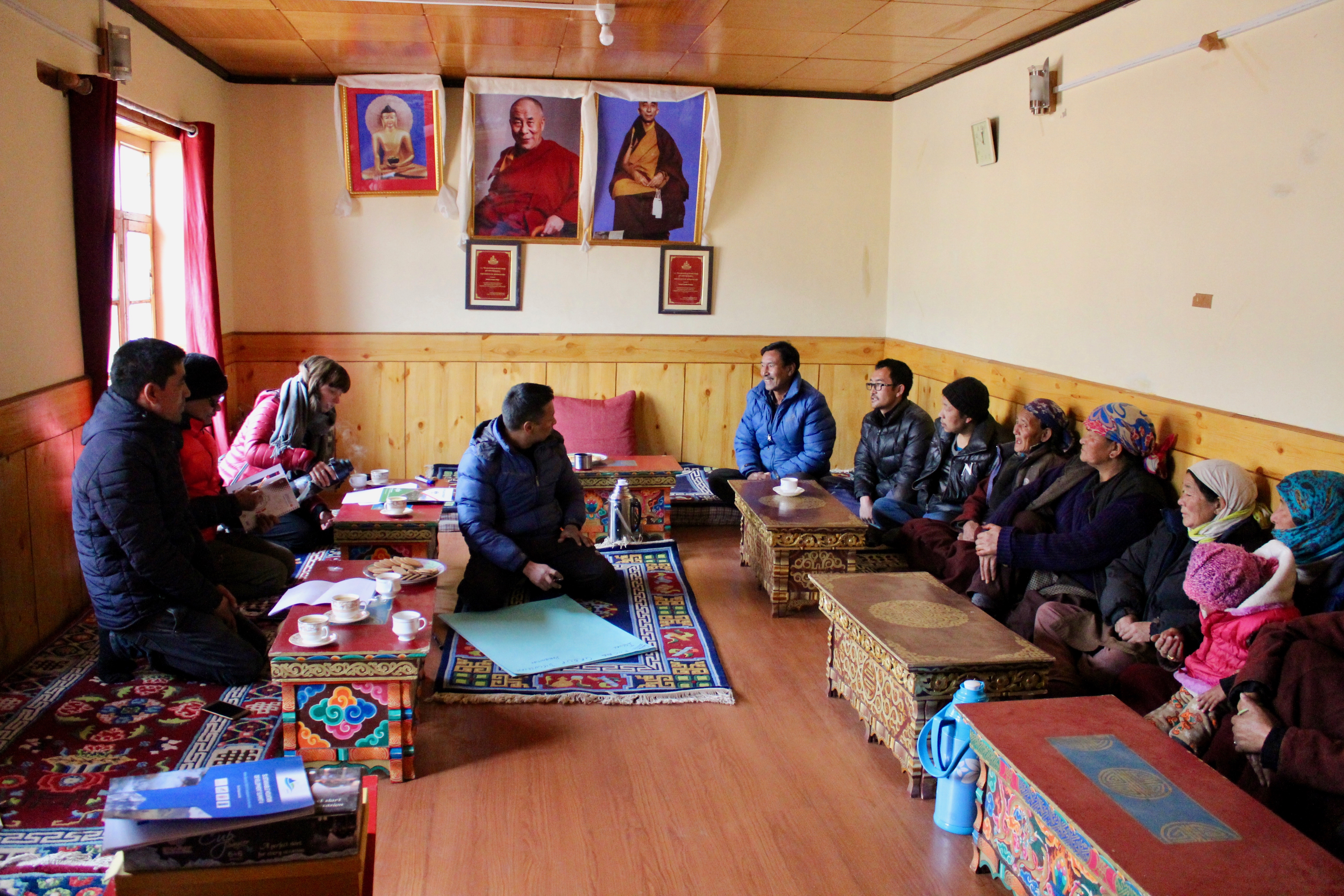
As The RAFT’s project manager, Sierra Gladfelter is responsible for working on the ground with different communities and stakeholders, coordinating and adapting each regional iteration of the overall project.

“What The RAFT really demonstrates is that community-driven aspect where we stick with localities beyond just the scoring and facilitating of a workshop to identify priorities,” she said. “We stay with them and help facilitate connections to our partners and to regional stakeholders and state and federal agencies that have resources. That is really where we can be of service to communities across Virginia and coastal localities.”

One of the unique aspects of The RAFT’s efforts in community engaged resilience planning is that it goes to where the people—and problems—are. “We listen,” Gladfelter said. “We work with them to rank their own priorities and then support them in taking steps towards actualizing their priorities and, hopefully, seeing things through to fruition within the course of a year. You know, to keep the ball rolling to continue resilience planning beyond our involvement.”

As a result of The RAFT team’s involvement, Colonial Beach has instituted long-term improvements. “We have a very small town staff,” said Luna. “But because of working with The RAFT, we now have the resources to enable them to become certified flood managers. That’s a very involved process. Having them certified will help us with future grant activities, but it’ll also help local planning so that we can zone appropriately for areas that we know are going to be inundated and flooded.” Luna said that the planning commission can also focus on resilience as a regional issue so that they can involve the Northern Neck Planning District as well as other jurisdictions. “Flooding doesn’t recognize town lines,” she said.

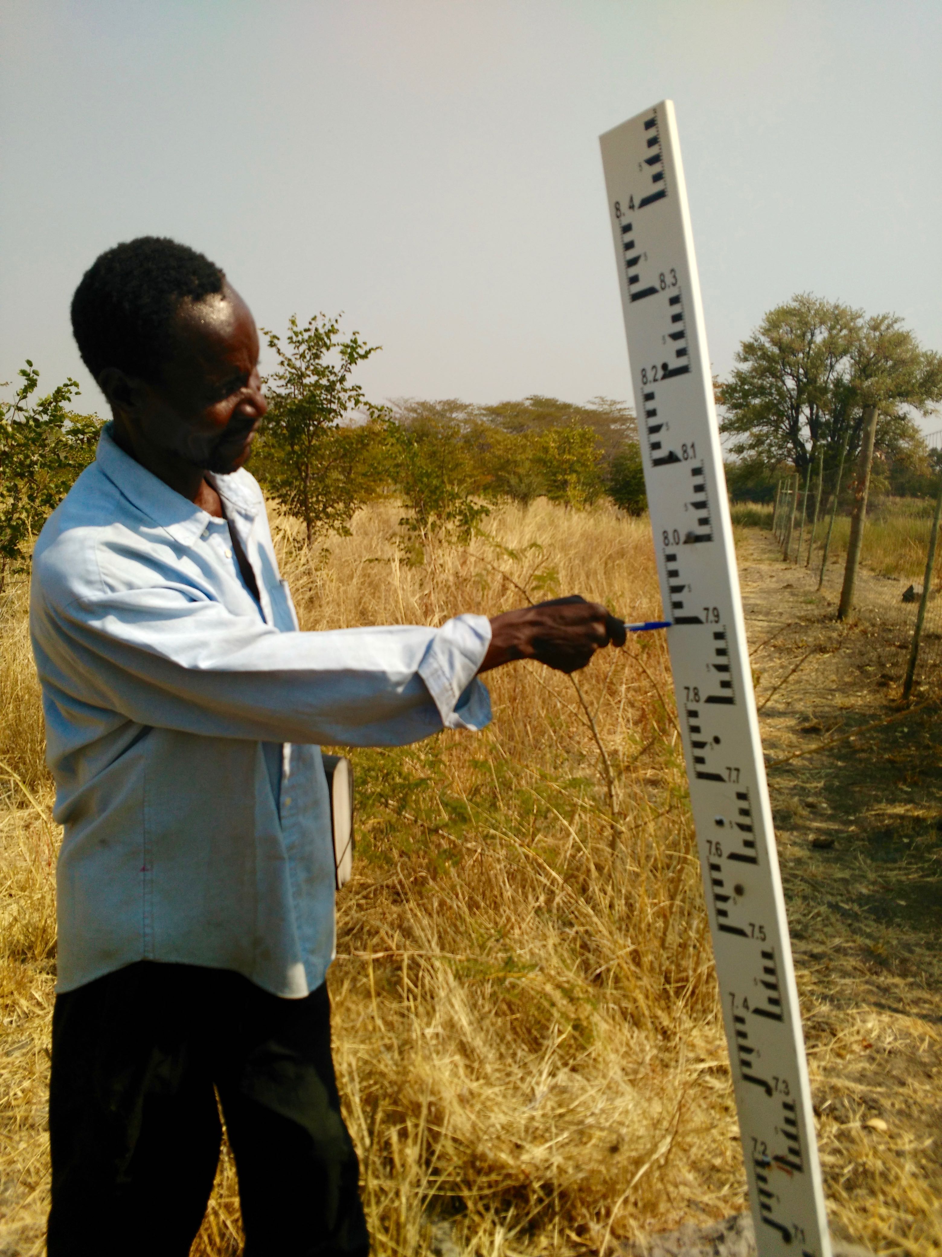
For her part as mayor, Schick must work within the limits of a municipal budget. “One of the things that The RAFT has done for us that we wouldn’t have been able to do on our own is provide a lot of data gathering and research,” she said. “Through The RAFT program, we have been able to accomplish a lot. It’s like having extra hands in our departments. Data gathering and mapping has been done by students. They’ve collected imagery and water depth topography along our shoreline. We have major erosion issues and it’s a high threat level to our community’s houses.”

Students in Karen Firehock’s class mapped several parks in town to help planners envision better uses for unused or underutilized space. Firehock is a lecturer in urban and environmental planning and landscape architecture in UVA’s School of Architecture.

“Park programming is a health and wellness issue, but it’s also a community safety issue,” Schick said. “They recommended local tree species and researched a comprehensive list of plants that are applicable to the kinds of solutions we need in certain areas.”

Schick is perhaps most excited about The RAFT’s assistance with a plan to relocate Colonial Beach’s rescue squad from a building located in the flood plain. “Obviously, they have a lot of equipment that is vital to the safety and security of our community and to the health and wellness of our citizens,” she said. “We have found an alternate location and are working to build a new facility in an area that is more centrally located and more accessible to the main thoroughfare.”

Adaptability + Equity = Resilience

The RAFT team’s long-term goal is to make the tool widely available for all coastal Virginia localities with the greatest need, risk, or interest. In recent years, The RAFT’s definition of community resilience has broadened to include social equity.

“Most of the work that has been happening in resilience has really been around environmental infrastructure and economic factors,” said Denckla Cobb. “What The RAFT is trying to do as it continues to evolve, is move more into recognizing that if you don’t have social resilience, the rest can only take you so far. It’s the piece that local governments have the least capacity to address.”

Gladfelter added: “We’re broadening the scope from flooding and the more traditional aspects of environmental resilience to thinking more about social, economic, and chronic structural issues that change on a different scope of time.”

When COVID-19 struck the U.S. in early 2020, The RAFT was finishing the scorecard assessment phase in Virginia’s Northern Neck and was planning a regional community workshop with eight towns and counties in the region. Recognizing the pandemic’s unprecedented nature and its relevance to resilience planning, The RAFT team pivoted to develop a COVID Rapid Response project that assessed the impacts of COVID-19 on the region’s ability to deliver critical services to vulnerable populations. At a presentation to the Northern Neck Funders Forum in March 2021, a representative from the Jesse Ball duPont Fund took notice.

“The duPont Fund wanted to learn more about how The RAFT was working at the ground level to better understand a community’s strengths and gaps in social resilience as well as opportunities to improve social resilience,” said Denckla Cobb. “We were so excited to learn that social resilience for the historically excluded and underserved was a priority for the duPont Fund, particularly when most of the federal and state funding is focused on resilience through physical and natural infrastructure.”

The full COVID report that resulted was based on interviews and focus groups with 63 individuals representing 43 social service organizations. It included an asset map that is now hosted and maintained by the Northern Neck Resource Council.

Chad Lewis is the community resilience coordinator for The Haven Shelter & Services, an intimate partner violence and sexual violence organization that serves the Northern Neck and Essex County. He also leads the Northern Neck Resource Council and was a partner on the asset map for the Northern Neck.

“One of my roles at the Haven is to coordinate the resource councils, which is how I got into contact with UVA,” Lewis explained. “We were able to look at some of these bigger systemic things that contribute to vulnerability. Once you start to pull back and take a more bird’s-eye view of everything, you see the same vulnerabilities for flooding are the same vulnerabilities for COVID-19. They persist here every day, even when there isn’t a natural disaster.”

Anne Nelson Stoner (Arch ’22) recently completed her master’s in urban and environmental planning. She was the principal student research assistant and lead report author alongside Denckla Cobb and Gladfelter.

“We talked to a wide variety of stakeholders in the Northern Neck to see how COVID impacted the delivery of social services,” she said. “We created an asset map and the goal was to start to fill this gap. There are a lot of services, but everyone’s working in their own silo. We started mapping out services and organizing them by categories and what services were being offered to whom, in what service area, who was the contact, just to try to better network people working in this world.”

“The RAFT team is incredibly good at making sure that they weren’t coming in and imposing a narrative onto the community,” Lewis added. “They definitely made sure that they were listening and getting everything that the community had to say in its own words.”

Stoner thinks that bringing people together is The RAFT’s greatest service to the community. “I think my big takeaway, both from The RAFT and from working with IEN in general, has been the degree of significance that collaboration holds in the real world,” she said. “We want quick answers and a lot of the problems we face today are not easy and quick solutions are not an option. There’s no way that we can come up with any kind of solution unless we can get everyone at the room to talk to each other.”

Fund for the Future

Since the report’s publication in August 2021, the duPont Fund has supported the dissemination of its information to other localities, supported discussions about its continued development, and explored potential ways to translate it into Spanish.

“The RAFT is a powerful tool to help build inclusion and belonging in the Northern Neck and Middle Peninsula communities, and we are proud to support this ongoing effort to grow economic and social resilience,” said Mark Walker, program officer for the Jessie Ball duPont Fund. “The deep listening by the IEN team, the data being collected, and the partners at the table are helping connect the dots so we all understand how we can best invest in community programs for the benefit of all community members.”

For Schick, the duPont Fund’s continued support for The RAFT means that she can continue to map out her community’s future. “Hurricane Isabel gave me a direction in life,” she said. “I didn’t know whether to call it community resiliency or community development at the time, but what it did for me is solidify that key component. I’m looking forward to The RAFT’s continued efforts with Colonial Beach and accomplishing our goals.”

Pipeline CSI: A volunteer army of citizen scientists is watching pipeline construction and safeguarding waterways

This article was written for and appeared in Blue Ridge Outdoors on March 29, 2019.

More than 50 residents pack into the Rockfish Valley Community Center in Nellysford, Virginia, to learn how to fight pipelines even as they begin going into the ground. Coordinators of the Pipeline Compliance Surveillance Initiative (CSI) are teaching this group how to analyze aerial photographs shot by airplanes and drones and report construction violations that they expect to see along the Atlantic Coast Pipeline’s 600-mile path through their little corner of Nelson County.

“Government officials have said that they don’t have the resources to investigate this stuff and that they are only going to be responding to direct complaints,” explains Joyce Burton, Friends of Nelson’s landowner liaison. “If construction continues, it’s going to take a lot of bodies on the ground and sitting at computers to keep up.”

Pipeline CSI has been hosting workshops across the region to build an army of citizen volunteers who are stepping up to protect streams and forests in their own backyards. The Pipeline CSI works through a mix of remote and local volunteers to ensure strict application of environmental laws and regulations for pipelines.

At least once every two weeks, the Pipeline CSI’s Air Force volunteer pilots fly the Atlantic Coast Pipeline’s proposed route with high resolution cameras taking 20 high-quality geotagged photographs every mile. Photos are uploaded to the Pipeline CSI’s state-of-the-art online mapping system where remote volunteers analyze the photos of active construction sites for compliance violations. If further investigation is required, CSI operators dispatch licensed drone pilots or first responders armed with cameras and water quality monitoring equipment to collect more nuanced, site-specific data.

If the Mountain Valley Pipeline (MVP) further south is any indication of what lies ahead for those resisting the ACP, however, it may be a long fight for the Pipeline CSI. Since construction began on the MVP in April, citizen volunteers with Mountain Valley Watch (MVW), a sister initiative to the Pipeline CSI, have presented over 500 violations to Virginia’s Department of Environmental Quality (DEQ). However, they have received very limited responses from DEQ.

“In the end, if DEQ doesn’t respond, then that’s when we bring in our lawyers,” says Burton. “We may be able to slow the pipeline down enough for several other pending legal challenges to make their way through the court systems. And even if we fail to stop this pipeline, by showing the inadequacies of what the regulatory bodies demand, we may have a role in changing the way pipeline decisions get made and what protections get put in place for future projects.” In this way, the Pipeline CSI is about much more than resisting the pipeline; it is also about empowering citizens to stand up for justice far beyond its path.

Says Burton, “We are writing the playbook for how citizens can respond to extractive industries even when the playing field is so tilted against us.”

Pipeline CSI is currently seeking citizen volunteers. Even if you do not live along a pipeline route, you can sign up at pipelineupdate.org/csi to review aerial photos collected by the Pipeline Air Force from anywhere with an internet connection. Thank you, Ben Cunningham, for providing images for this piece.


Spending Time in the Path of a Proposed Pipeline

As we turn onto the dirt lane leading to Spruce Creek Camp-Out up the hill, we run into a small group of folks walking down the road. My husband and I have driven out to Nelson County to join the last of three weekend campouts in October organized by activists on land threatened by the Atlantic Coast Pipeline (ACP). We are invited to pull our car off the road and join the group on a nature hike led by Robert Jennings, a local naturalist and grassroots field specialist for the Chesapeake Bay Foundation. This is only one of the many talks, presentations, and tours of local properties that would be impacted by the pipeline that are being offered by Nelson County residents and invited experts during the Spruce Creek Camp-Outs.

We pause every few meters walking along the land of Jill and Richard Averitt, who have been fighting the ACP that threatens to bisect their property for the past four years. Jennings kneels to pick up a seed, pulls our eyes up the long straight trunk of a tulip popular tree, and passes around a birch twig, inviting us to scrape off the fragrant bark with a thumbnail. “Rootbeer!” someone exclaims. The adults are as full of wonder as the kids. The woods are alive with so many gifts if only we pause to appreciate them. Having someone like Jennings along can help to slow us down and bring more meaning to our interactions. It also makes what is at stake here strikingly clear.

IMG_3886
The main campsite at Spruce Creek. 

As we reach Spruce Creek, I realize this walk has been a pilgrimage for many here. The sun is setting and the last light filtering through the forest sparkles on the water. Standing on the banks of this native trout stream, I can make out a faint line of orange flagging ribbon running through the trees. This is the proposed-path of the ACP, where—if built—it will tear through this small piece of the Rockfish Valley on its 600-mile path from the Utica and Marcellus gas fields of West Virginia to its terminus in eastern North Carolina. As I listen to the deafening stream, so full of energy in its rush from the Blue Ridge Mountains to the sea, it is hard to imagine this beauty being broken. And yet, this is the fragility of the world in which we live. All of it requires our protection.

On our climb back to Camp to set up tents and prepare for an evening of educational talks and communion with other campers, landowner Jill Averitt points out a string of hand-painted prayer flags dancing in the trees. Made by past campers and volunteers, the ever-lengthening line is strung across the pipeline’s ‘right-of-way’ through the heart of their property. I think about the contractors’ orange ribbon also strung through these trees. The woods, for the moment, are silent holding these competing dreams in their swaying arms.

IMG_3884
Prayer flags in the path of the proposed pipeline.

After setting up our tents in the trees around a meadow, we congregate in its center for dinner. Mike Tabony, a retired tug boat captain from New Orleans turned local climate activist, gives a humbling presentation on the state of climate science. He is self-trained, the most inspiring kind of citizen scientist, who after living through Hurricane Katrina, gave up flying, buying new cars, and has lived a simple life since sharing his knowledge of global warming with others and inspiring them to action.

As the night gets colder, we circle round the fire. Friends and neighbors from Nelson County share stories of their own fights against the pipeline, the court battles they’ve weathered and Congressional hearings they’ve testified at, the stress and sense of loss they’ve suffered, and the fight they’ve supported and are still supporting their friends through. One couple has driven up from Hampton Roads, where their own community is struggling to organize in opposition to a spur of the ACP that is already on its way into the ground. They are here for leadership and inspiration, coming from a community where so many folks, too down on their luck to fight Dominion Energy, have taken a check and gotten out. Fresh to the fight and the full complexity of how pipelines are built and resisted, my husband and I simply listen and take it all in.

IMG_3286 (1)
Campers at Spruce Creek. Photo by Jill Averitt.

To be invited so intimately into peoples’ lives and personal struggles feels like such a gift. I do not yet know what I can do to help, but for the moment just gathering and being present seems important. Although some consider it to be a done deal, this fight is far from over, and even if the ACP goes in the ground, folks all along its path will be standing by their land, protecting what they can, and reporting issues that will impact all of us who live downstream.

For more information on how you can get involved from wherever you are, get in touch with the Allegheny-Blue Ridge Alliance and check out the Dominion Pipeline Monitoring Coalition, which is rewriting the books on how citizens do science and resist projects such as this.

This blog post was originally composed for Wild Virginia.

Building a Web of Water Security: One Kumaoni Village’s Effort to Buffer Themselves from the Effects of Climate-Exacerbated Scarcity through the Construction of Water Storage Tanks

IMG_1571

Photographs and text by Sierra Gladfelter

This article is based on field visits and interviews conducted with residents of Pata and Galla villages in Nainital District, Uttarakhand, India from May 18-19, 2018.

High in the hills of the Kumaon region of Uttarakhand, India, Pata is a village where people have been creatively modifying their livelihoods and local agricultural practices to adapt both to a changing physical environment and local economy. This village of 80 households, which is situated at approximately 6,000 feet in elevation, has been a horticulture centre for apple production since the British introduced this crop in the 1860s to the hills surrounding their summer headquarters in the district capital of Nainital. Since the local climate makes Pata ideally situated for orchards and because of its relative close proximity to markets, this is one area in the region where agriculture and land-based livelihoods continue to remain economically viable and men are not forced to migrate to the plains and other parts of India for wage labor. As a result, it is more common in Pata for families to work together in their small-scale orchards and fruit nurseries, with both women and men participating in most activities related to cultivation.

IMG_1606
Figure 1.  A view of Pata village with various polythene-lined water tanks visible with their green covers.

Yet, as in much of the Himalayas, climate change is having its impacts on Pata’s orchards and on villagers’ livelihoods. Dwindling rainfall, particularly low intensity rains over extended periods that are the most useful for agriculture, has impacted crop production. Like most villages in the region, Pata has traditionally practiced rain-fed horticulture, and until recently has been wholly dependent on precipitation for a successful harvest. This makes farmers particularly vulnerable to climate change as rainfall has become increasingly more intense and intermittent in the Himalayas. Rising temperatures have also affected agriculture and horticulture in the region. Over time, apples, which prefer cooler climates, have become less productive and preffered by villagers in the region. Warmer temperatures are better for peaches, plums, and apricots, so over the past 20 years, villagers in Pata have begun to replace their apple trees with these fairer-weather fruit trees, and shift their apple orchards to higher terraces.

IMG_1556
Figure 2. One of Pata’s upper terraces where potatoes have been planted under young apple seedlings.

Interestingly, the topography of the region with its steep hills and narrow terraces contouring the mountain sides seem to provide diverse micro-climates at varying elevations which people can use as an adaptive advantage by adjusting the elevation at which they plant different crops. Pata residents are also experimenting in their nurseries with developing new local varieties of fruit trees that are better adapted to the local climate and that also have higher market values. Alongside these efforts, residents with the support community organizers have been working for the past three years to get their fruit certified as organic. Although local horticultural practices have always depended on organic composting and non-chemical pest control, this recognition and certification is in many ways evidence of communities’ own adaptive strategies and creativity to better compete within a changing market economy.

IMG_1594
Figure 3. Fruit crates sitting outside a home waiting to be filled with produce to send to markets in Haldwani.

In addition to these efforts, Pata provides an inspiring case study to examine how one village is adapting to the changing patterns and growing unreliability of rain associated with climate change through the construction of water storage tanks that help ensure a timely and regular water supply. This year, with support from the Almora-based NGO Uttarakhand Seva Nidhi Paryavaran Shiksha Sansthan (USNPSS), the villagers of Pata constructed 90 plastic-lined water tanks in their village in the course of only three months. The idea for this intervention came from the villagers themselves who had been discussing in community forums organized by the NGO the various challenges that they face each year with sparse rainfall in the months leading up to monsoon. This winter, in particular, the village had not received any precipitation since monsoon ended in August and people were concerned about what this would mean for their livelihoods come spring. USNPSS had previously experimented with building water storage tanks in the neighbouring village of Galla and offered to work with Pata to attempt a similar intervention informed by their past experience. Inspired by the opportunity to protect themselves from the erratic and fickle nature of rains, every household of Pata mobilized themselves and enthusiastically constructed 90 tanks. By the end of February, everyone had built at least one reservoir, working together to make this feat possible before the agricultural season began.

While USNPSS provided the plastic polythene lining and synthetic green covers, villagers did all of the labor and construction themselves. This involved each household hand digging a 10,000-liter tank (approximately 10x10x4 feet deep) over the course of two to five days, usually on their uppermost terrace, and then plastering the walls with six to seven layers of mud and cow dung. This technique, used in the traditional construction of homes and terraces, ensured a smooth surface on which to lay the polythene tarp. Those villagers who had previously built their own water tanks out of concrete had found this material vulnerable to cracking and not sufficiently flexible for the region’s intermittent seismic activity and fluctuating temperatures. It was also expensive and difficult to repair (a concrete tank might cost 20,000 to 30,000 rupees to build while the price of replacing a polythene tarp for a tank of this size was one tenth this price).

IMG_1530
Figure 4. USNPSS community organizer, Mahesh Singh Gallia, uncovers one of the new polythene tanks in Pata.

Based on this experience, residents opted to build their tanks with lower cost and more flexible materials and use local technologies in construction. While neighbors labored together to carve each other’s tanks out of the rocky soil, the village organized a committee to visit each household to check that the reservoirs were being properly constructed before the polythene tarps and tank covers were distributed by USNPSS.

“It was like a festival in Pata when everyone was digging tanks,” shared community organizer, Bacha Singh Bight. “Everyone was working on something together.”

By March 2018, the whole village had completed the construction of their tanks and they were ready to connect them to Pate’s four perennial springs and fill their reservoirs with water. As USNPSS did not provide the community with pipes, but rather allowed the villagers to coordinate their own connections, this was done through a gravity-fed system of plastic piping and some small electric pumps that already existed in the village. Before this intervention, 25 of the community’s wealthier households had already invested in their own personal (mostly concrete) water tanks and pipelines, and so after the construction of the 90 tanks, these personal pipelines became the shared infrastructure securing the entire village’s water needs. The villagers formed several linear chains down the terraced hillsides from these 25 pipelines, whereby the upper most tanks were filled directly from the spring and then these households distributed water to the tanks of the neighbors below them. As one community organizer and local volunteer described it, the result was a tangible manifestation of the village’s connectivity—both the physical infrastructure of the pipes linking the 90 water tanks and the village relationships that made this network possible.

IMG_1686
Figure 5. A cracked concrete tank that has been repurposed and lined with polythene as part of the project.

Having this access and capacity to store spring water for irrigation enabled the people of Pata to flood and soften the earth prior to planting this year, increasing soil moisture and ensuring adequate water for their sensitive cash crops like peas. In just this season alone, residents have experienced an immediate economic benefit from the tanks and competitive edge in selling their crops, since they had access to water for irrigation when neighboring villages without reservoirs were forced to wait for the fickle summer rains. While only the first crop has been harvested since the tanks were built, many villagers reported having more than doubled their income in terms of the amount and quality of the peas that they were able to sell this year compared to last. While local leaders claim that most villagers made around 35,000 rupees in pea sales this year (a rough estimate that needs to be verified), some households were able to generate as much as one lakh (100,000) rupees in sales—an amount unheard of prior to the construction of the polythene ponds.

In addition to irrigating their fields, orchards, and fruit tree nurseries, people have also been able to use their tanks for washing and watering animals, as well as accessing drinking water in ways that they had never been able to before. This is particularly beneficial for those households who did not have the economic resources to make their own tank or finance a personal pipe connection before. In Pata there is no reliable piped government drinking water. A scheme in the early 2000s to pump water from the stream in the valley below failed as access was intermittent and most of the water was captured and consumed by wealthy developers who have built private cottages on the ridgeline, leaving very little to trickle down to villages below. With the new polythene tanks and pipe connections, however, people can now also store spring water in household vessels when it is their turn to fill their tank, reducing the amount of time and labor that women expend walking to the spring and transporting water. While these water storage tanks are most crucial for irrigation during the pre-monsoon months from March to June when rainfall is scarce, Pata farmers plan to also use them as a buffer throughout monsoon particularly during dry spells and long stretches without rain, which are becoming more common with climate change.

IMG_1553
Figure 6. A household tank being filled to enable continued irrigation throughout the agricultural season.

In these ways, Pata is a community that has essentially built in the course of a few months, an entire network of irrigation infrastructure in a place where this was never previously necessary. Unlike other arid places of India and the Himalayas where water has always been scarce and people have rich histories and traditions of capturing water during times of plenty to cope with scarcity, the foothills of Uttarakhand never had such explicit traditions of water harvesting and distribution. In some places, villagers dug khuls or ghuls (earthen canals) to irrigate their fields, but for the most part rainfall was sufficient and people could depend on regular water delivered by the skies. In this way, adaptation to a changing climate requires new innovation, and in places like Pata and the surrounding hills of Kumaon, possibly even making entirely new physical systems and social structures for managing, harvesting, and distributing water. Pata’s industrious construction of 90 water tanks and collective system of distribution developed during this past year, with its flexible pipes and plastic-lined tanks, use of local construction technologies, and repurposing of cracked concrete tanks, is a prime example of the kind of adaptation and innovative coping strategies that will have to occur in the coming years. This is particularly true if viable agriculture-based livelihoods—subsistence, cash-crop or otherwise—are to be maintained amidst a changing climate.

IMG_1655
Figure 7. In neighboring Galla village, a man packs organic peaches in pine needles for transportation to market.

Yet, I would argue that despite this project’s immediate success and the way in which it can—and already is—inspiring neighboring communities to execute similar projects, it is important to consider both the limits of this kind of adaptation as well as some of the subtle inequalities in how an intervention like this serves individuals within the broader community. Those individuals with whom I was able to speak and who were also most active in organizing and executing the project insisted that there were many more conflicts and issues with water sharing prior to the intervention which essentially built more equity into the community by supporting each household in building their own water storage tank. Before this project, only the wealthiest and most enterprising households could afford to construct their own reservoirs, purchasing pumps and private pipelines to divert water from the collectively-owned spring to their personal fields and orchards. While this project certainly does not equalize uneven wealth within the community, those most actively involved in community meetings and organizing expressed how through this kind of grounded social work they were able to build better relationships among neighbors and collective ownership of the project. As a result, people with more resources and access to water distribution infrastructure (pipes, electric pumps, etc.) were willing to share and put it to use not only for themselves, but also for the benefit of their neighbors.

IMG_1567
Figure 8. Pipes snaking to the base of one of Pata’s four springs serving the village’s new irrigation system of tanks.

While this community solidarity speaks to the hard work of USNPSS staff and volunteer organizers, I wonder how sustainable this social connectivity and sense of altruism will be unless the villagers decide to create some mechanism to institutionalize equal access and set water sharing rules. After all, there is certainly the possibility that the current system of individual tanks and pipe connections could enable a more self-interested turn toward competitive exploitation of limited water resources. While USNPS’s intervention has been able to build greater equity in terms of people’s capacity to store water for irrigation, the fact remains that a tank itself is useless unless one has the means to access and deliver water to it.

In this way, whether one has a pipe or not is precisely what determines access and shapes the unevenness of distribution. In the system that currently exists, one fills his or her tank depending on personal use on a first-come-first-serve basis. When one finishes all the water in his reservoir, he either connects his own pipeline directly to the spring or to his neighbor’s tank. As there is no current rotation or turn-wise system, each resident’s capacity to frequently refill is determined by her or his proximity to the spring (i.e. if one can easily go to check when the tap is free) and capacity to access it (having one’s own pipeline versus depending on the altruism of neighbors). For example, one enterprising man with his own connection had been able to fill and use the water in his tank nine times this season, while two other men, for various reasons, had only managed to utilize two tanks.

Currently, there is reportedly enough water flowing from the springs so that all villagers can fill their tanks and those with pipes are happy to share when their reservoirs are filled. However, the uppermost households closest to the springs are able to fill their tanks in 24 hours or less, while lower households further from the source, described having such limited flows that they left their private pipes flowing continuously and could only afford to disconnect them and share water with their half a dozen dependent neighbors only when others were totally out of water. This reality illustrates inequalities in access to water within the village depending on how one is physically situated in relation to the water source as well as the resources one has to ‘buy’ a private connection. While this is easy for the wealthiest households with earnings from extensive orchards and land holdings, the average cost of a pipe is 20,000 to 50,000 rupees for 1,000 to 3,000-meter connection; a substantial investment especially for less affluent families.

IMG_1571
Figure 9. Local women disconnect an irrigation pipe to get a drink of water when passing by a spring in Pata.

This raises the question: if rainfall and spring discharge continue to dwindle and there is no longer sufficient water to meet the new demands of irrigation, will the people of Pata develop new structures of water sharing or rather opt for a system of individual competition to exploit a dwindling resource? I ask this, because I have found that even in places like Ladakh where irrigation infrastructure and social systems have existed for hundreds of years to equitably manage and distribute scarce water resources, the impacts of climate change along with a growing trend towards individualism and participation in a cash economy, have begun to erode collective systems of ownership, maintenance, and cooperation. If this is the case in a place that has strong traditions of water management, I wonder whether a village like Pata that never had systems for managing water collectively and does not currently think that establishing some form of governance is necessary will decide later to respond to scarcity through an equitable water sharing system.

One community organizer assured me that life in a village requires people to share and support one another and that because of this, institutionalizing water sharing norms is unnecessary. However, I wonder to what extent this only romanticizes village life and a moral economy of social cohesion and goodwill that may or may not have ever existed, and that from a social justice perspective, I would argue should not be taken for granted in the future. Even if this project has been able to create more equity in access and better water sharing between villagers, this cohesiveness and communal sharing, at least to me, seems precarious. Particularly, if the income generated from produce grown on irrigated land this year continues to be strong and people recognize the value of having and controlling access to water in their fields, people could become less interested in sharing with one another and decide to keep more water for themselves. As it is, even with pathetic flows to less-well positioned tanks, the people of Pata want to build at least 25 more reservoirs in the coming years. If discharge continues to dwindle, what might an extension of the current system mean for those with less access and means to bring water to their tanks?

IMG_1575
Figure 10. A man connects his pipe to a puddle of ‘wastewater’ rather than compete with for access to the spring.

I pondered this while standing by one of the springs supporting Pate’s new irrigation system with a group of villagers and NGO workers active in the project. While several villagers had assembled to present their appreciation of and benefit from the project, I could not help but turn and follow the flow of water down the nalla with my eyes. There, in several places below the spring where there was only a trickle in the canal, people had scraped away small depressions and had sunken their pipes with weighted stones into the puddles like straws. When I asked why these many pipes snaking up the nalla did not simply wait for their turn at the spring, someone explained that this ‘wastewater’ was “easier and free to access” compared to competing for time connected to the main source. This, I think, reveals how equity does not inherently emerge in water sharing without its intentional structuring. Yet, the reality is that no NGO can ensure this or build new social systems for water sharing, if people do not create and choose to live by them themselves.

IMG_1589
Figure 11. In the canals below Pata’s springs, people try to syphon whatever water is left in puddles to their fields.

Additionally, for better or worse, this project and the extensive system of water storage tanks that it has extended creates the new issue of competing water uses. While villagers previously relied only on rainfall for watering their crops, the 90 tanks and piped infrastructure built this year in Pata, put more demands on water sources that previously only had to fulfill the village’s drinking water requirements. Although villagers insist that use of the springs for drinking water purposes takes precedent over irrigation and that people retain the right to disconnect anyone’s pipe to fill their water vessels, as the economic value of being able to irrigate one’s fields and orchards becomes established, I wonder if new conflicts over competing uses will emerge and how they will be managed. Just as this intervention became necessary to build and extend physical irrigation infrastructure in a place where it never previously existed, the same kind of need may emerge for the establishment of a governance structures to balance use as well.

IMG_1643
Figure 12. Women and children in the neighboring village of Galla wait in line to fill their jugs with drinking water.

Fundamentally, the fact remains that regardless of how innovative and successful Pata’s whole system of water tanks and piping is in terms of the economic benefits that it has been able to provide to participants, without a healthy spring, the current system let alone an expansion, is not possible. The health of Pata’s springs is affected both by climate change and development patterns, both of which have exacerbated dwindling discharge and neither of which the community has much control over. Village women, for example, reported a direct connection between declining rainfall in the last 10 to 15 years, and the vegetation of forests which contribute to recharge and the amount of discharge exuded from springs. In the same period of time, there has been extensive development of roads and cottages for tourism along the ridges above their springs. These developers, which have sunken bore wells and fashioned private pipes to local water sources for their resorts and summer homes, have affected groundwater directly through exploitation and by disturbing the hydrology of the mountain tops and ridges which recharge village springs below.

Residents of Pata and nearby villages have tried to resist the negative impacts of development and exploitation of water resources in their headwaters through legal battles at the District Magistrate’s office in Nainital. This activism began with the construction of the Cloud 9 resort in 2005 which had attempted to block and pump water from one of the village’s local springs to service its 150 summer cottages strung along the ridge. This led to the formation of several informal women’s groups and later a larger federation that has remained active in working on issues of water, soil, and forests directly connected to their agriculture and horticulture-based livelihoods. Although the villagers of Pata were successful at protecting their right to local springs from Cloud 9 developers, the reality is that they essentially managed to only displace the exploitation of water resources from surface resources in the upper watershed to other forms of extraction through bore wells and private pumping systems.

IMG_1697
Figure 13. Here Cloud 9 is visible in the distance on the ridge above Pata. This is only one of many resorts erected in the past 15 years that now compete with local people to fulfill their water needs.

While this is a battle that will have to continue to be fought, for the time being, the people of Pata seem to see solutions, or at least ways that they can intervene in securing their water resources, in the management of their van panchayat, or local forests. In Pata, residents are currently discussing interventions that they can make in their 850-hectare forest to recharge springs and protect vegetation. Together, with USNPSS’s community organizers, they are developing a plan to harvest rainwater and recharge springs by digging trenches and infiltration ponds in the forests that they have direct control over. If the community can manage to get the technical expertise to make this intervention effective and support from other organizations that have spent decades in nearby watersheds developing methods for training local people to assess their own local geo-hydrology and place infiltration pits accordingly, this project has the potential to support the existing irrigation infrastructure Pata residents have built and perhaps even allow for the expansion of more tanks. However, it is also necessary to recognize that people have limited control over their watershed, particularly with the rapid development of more than 100 hectares of privately-owned forests on the surrounding ridges. Therefore, if water scarcity is to be solved in a place like Pata, these other players who now depend on and extract from the local ecosystem will also have to become part of the solution.

Thus, even in the midst of celebrating the success of an adaptive, creative and energetic community like Pata in trying to cope with climate change and protect its most important natural resources against development, it is important to acknowledge the limits of local adaptation and the capacity of villagers to protect their own forests and springs alone against the entangled forces of change. After all, while Pata has been able to design and innovate a decentralized form of water distribution to more efficiently put to use its limited water resources and buffer itself against changing precipitation patterns, other villages like neighboring Galla have less options for adaptation with fewer springs located below the village and greater dependence on the government’s intermittent piped drinking water scheme. This recognition, I think, in terms of what is and can be achieved is important when NGOs come into communities to work on local problems. Too often big promises are made to both villagers and donors, when a more grounded discussion about small adaptations that can be taken locally while also recognizing that real solutions must also be structural and extend beyond village boundaries, may be more productive.

Of the many NGOs that I have interacted with working on climate adaptation and water management in India, USNPSS is perhaps one of the most honest about what its interventions are able to achieve and careful in its role facilitating community-owned and identified projects. USNPSS is clear that building 90 water tanks in Pata will neither save their world nor fundamentally solve villagers’ more basic water problems. True solutions to challenges as big as these—water security, climate adaptation—cannot be assembled overnight by even the most hard-working of institutions and also cannot be solved within individual villages alone. No community, however rural, is isolated from the forces of change, both climactic and developmental, around it. Yet this project has, as USNPSS director Dr. Lalit Pande asserts, “given people something to do”—a project to labor on that they can own, see a direct benefit from, and that brings them a small step closer to water security as a community. This, in itself, is something worth celebrating.

***

Sierra Gladfelter is an American Fulbright Nehru Student Research fellow based in India for one year while studying climate-exacerbated water scarcity and the ways in which communities are creatively adapting to these changes in Ladakh and the Kumaon region of Uttarakhand. She has a Master’s degree in geography and a certificate in development studied from the University of Colorado Boulder and a Bachelor’s degree in anthropology from Temple University. Her research interests include the politics of knowledge, vulnerability, and social justice issues that surround climate adaptation and disaster management programmes across the developing world. Sierra has conducted critical academic research in both India and Nepal and has applied experience outside of academia studying climate change, resilience, and the uneven process of recovery from disasters along rivers in Zambia and the United States with the Red Cross Red Crescent Climate Centre and the Institute for Social and Environmental Transition. Follow her work at www.sierragladfelter.com.

Ladakh’s Artificial Glaciers, Ice Stupas, and Other Attempts to Survive a Warming Planet

By Sierra Gladfelter and Eben Yonnetti

This photo essay was originally composed for the University of Colorado Boulder Tibet Himalaya Initiative’s website.

A land of glaciated peaks and windswept valleys situated in the Himalayas’ vast rain shadow, Ladakh has long been home to a hearty people who devised complex systems of irrigation and agriculture to survive and even thrive in this high-desert landscape. Located on the western edge of the Tibetan Plateau, this region of only several hundred thousand people was once a crossroads of cultures and regional trade hub. After it was absorbed into the Republic of India in 1947 and its borders with Pakistan and Tibet were closed, however, Ladakh became little more than a strategic defense area for the rest of India. Its place on the periphery only changed after Ladakh was opened to tourism in 1974 and later idolized in the 2009 Bollywood blockbuster Three Idiots. Now, with hundreds of thousands of tourists each year, unprecedented rates of rural to urban migration, and the Indian military continuing to expand its border presence, Ladakh has struggled to deal with the growing demands placed upon its natural resources.

In addition to social and political changes, climate change has transformed Ladakh into a landscape in environmental crisis. In just the last six decades, the Indian state of Jammu and Kashmir of which Ladakh is a large part, has lost 20% of its permanent ice reserves (Clouse et al., 2017). Considering that 85 to 90% of Ladakhi villages depend completely on glacier and snow-fed catchments for their water and that annual average rainfall is less than two inches (Norphel & Tashi, 2014), rising temperatures and dwindling snowfall do not bode well for the region’s future water needs. Moreover, what precipitation does occur is increasingly received in the destructive form of short and intense cloudbursts that the landscape cannot absorb (Dorjai & Mordelet, 2012).

In response to these intense environmental and social changes various non-governmental organizations (NGOs), government agencies, and even religious groups are mobilizing local peoples to build a more climate resilient Ladakh. Rather than mitigating scarcity through efforts to reduce use, however, many interventions attempt to capture Ladakh’s shrinking water resources before they are ‘lost’ downstream through the construction of various water harvesting technologies like ‘artificial glaciers.’ These structures are essentially human-made ice banks designed to collect and store water in the winter for spring and summer agriculture, and in some cases, are even used to irrigate and ‘green’ the desert.

Although ice reservoirs were built traditionally using various techniques in the Ladakh-Baltistan region, their contemporary form as ‘artificial glaciers’(AGs) was pioneered by civil engineer Chewang Norphel in the late 1980s. Norphel’s AGs are built as a series of terraced ice fields in or along a stream channel. One method involves diverting a portion of a stream to a shaded bank where it is forced through a series of check dams that slow its flow and increase surface area to expedite freezing. In another, the dams are built directly in the streambed to achieve similar results. First built by Ladakh’s Rural Development Department and the Leh Nutrition Project in a handful of water scarce villages, AGs are now receiving interest and investment especially among corporate donors. In 2017, for example, the Tata Trusts (which have already built five AGs around Leh) began assessing the feasibility of constructing AGs in 34 potential villages.

Inspired by Norphel’s work, Ladakhi engineer and social reformer Sonam Wangchuk invented another type of ice reservoir he dubbed the “Ice Stupa.” The name comes from its conical shape, which resembles a traditional Buddhist stupa or reliquary mound, and allegedly can be built at lower elevations since it melts slower than terraced AGs due to its shape and smaller surface area. After constructing a prototype in the winter of 2013/2014, Wangchuk’s work was recognized by the Tibetan Buddhist leader, His Holiness Drikung Chetsang Rinpoche, who offered funds, labor, and land near Phyang Monastery to support a scaled-up version. The next year, Wangchuk and his team constructed a larger Ice Stupa near the village of Phyang to irrigate a plantation of 5,000 trees planted by Chetsang Rinpoche’s environmental organization, Go Green, Go Organic. In the years since, the Ice Stupa Project has continued to experiment with different materials and construction techniques to improve their technology so that it can become applicable and affordable for villages on a large scale.

Most recently, with direction from Chetsang Rinpoche, two monks from Lamayuru Monastery have also started to work with villages in Ladakh’s Sham Valley to experiment with low-tech ice reservoirs. Compared to Norphel’s AGs and Wangchuk’s Ice Stupa, these small-scale “artificial icefall glaciers” are less expensive and technical, involving little more than a pipe laid out between a spring and a shaded cliff face. The water conveyed is sprayed onto the rock wall below to form a frozen waterfall. First built in the village of Kuksho in the winter of 2016/2017, the project has since expanded into two nearby villages.

While much of the world is looking to Ladakh and its AGs for inspiration, it seems that a more critical look at these interventions is warranted. Maintenance, for example, has been a challenge since Norphel built his first AG. With little budget for follow-up visits or maintenance, most AGs are essentially abandoned after construction for local villagers to maintain. However, many of these structures are built far above villages and as external interventions have eroded collective-labor practices, repairs initiated by locals are rare. This might explain why more than half of Norphel’s earliest AGs have either gone completely or partially defunct (Clouse et al., 2017). The monks initiating the artificial icefall glaciers have been able to partially avoid these challenges by capitalizing on villagers’ devotion to Chetsang Rinpoche to recruit volunteers to monitor and maintain these structures. Nevertheless, the demands that religious leaders can make of their followers’ time and labor have a limit. Even devotion can only be stretched so far.

Most importantly, Ladakh’s ice reservoirs, in any form, are not a solution to climate change or scarcity in the long-term as they only preserve, for a few months, water that is already present in the mountains. No matter how high-tech AGs become, they can do little if Ladakh’s natural glaciers continue to disappear and the skies refuse to snow. Humility, however, is often lacking in interventions. The Ice Stupa Project, for example, invites visitors on its website to “join Ladakh as it gears up to fight climate change and melting glaciers.” The reality, however, is that AGs are not a weapon to combat climate change, but are rather a way for Ladakhis to cope with its most immediate effects and to try to hold on, at least for now, to life in this landscape.

This photo-essay captures the dreams and realities surrounding AGs in Ladakh. Informed by three months of preliminary research in Ladakh, it presents some visual evidence to accompany the authors’ reflections while on Fulbright-Nehru Student Research grants in India.

IMG_3595 (2)
The majority of Ladakh’s population live in irrigated valleys that are fertile and verdant compared to the dry, rocky mountains and desert that surround them. Photo by Sierra Gladfelter.

IMG_3932 (1)
Glacier and snow-fed springs and streams provide both irrigation and fertile grazing patches for the region’s herds of yak, goats, and sheep. Photo by Sierra Gladfelter.

IMG_3655
Recently, local religious leaders have started to take an active role in environmental projects in response to climate change. One of the most prominent, His Holiness Chetsang Rinpoche, has been especially active in promoting tree plantations through his local NGO Go Green, Go Organic. Photo by Eben Yonnetti.

IMG_4027
An example of a recent tree plantation organized by Go Green, Go Organic. This project in the village of Phobrang began in 2015 with volunteers from numerous villages planting 5,000 trees, mostly willows, in an attempt to ‘green’ the desert. In subsequent years, Phobrang’s villagers have added more than 15,000 trees to this plantation. Photo by Sierra Gladfelter.

IMG_7951 (1)
The Tata Trusts have become one of the largest funders of ‘artificial glaciers’ in Ladakh, financing the construction of seven such structures since 2013 through local NGO partners. Photo by Sierra Gladfelter.

IMG_8045
Villagers in Nang must manage flows in their irrigation canals throughout the year. An artificial glacier built by the Leh Nurtition Project directly in the stream channel is visible in the background. Photo by Sierra Gladfelter.

IMG_8021 (1)
This close-up of one of Nang’s artificial glaciers reveals the outlets in each check dam for the stream to flow through in summer months. In theory, villagers are supposed to close these outlets with stones in the fall so that in the winter water will be slowed and forced to spread behind the check dams, leading to ice accumulation. When the authors visited this site at the end of December, however, little ice had formed. This style of Norphel’s artificial glaciers is the least technical and expensive, easiest for villagers to maintain, but is also most prone to damage due to fluctuating discharge and flash floods. Photo by Sierra Gladfelter.

IMG_8842 (1)
 This photo shows the storage tank and diversion canal for the second type of artificial glacier designed by Norphel. In the fall and winter, villagers must open and maintain a gated inlet and canal that diverts stream water into a system of terraced walls that help to accumulate ice. In the spring, villagers are supposed to close off the inlet to prevent damage due to higher discharge volumes and sediment loads. Photo by Eben Yonnetti.

IMG_8793
One in a series of terraced dry stone masonry walls used at the Likir artificial glacier to collect ice. This artificial glacier was constructed in 2017 by local villagers and the Ladakh Environment and Health Organization, with funding from the Tata Trusts. Photo by Eben Yonnetti.

IMG_8794
A view from over the first rock wall dam looking at the terraced ice fields above the village of Likir. Photo by Eben Yonnetti.

IMG_8928
 One of the authors, Sierra Gladfelter, taking notes at the Likir artificial glacier during a follow-up site visit by Ladakh Environment and Health Organization staff members and villagers to check on ice accumulation. Photo by Eben Yonnetti.

IMG_7519 (1)
An overview photo of the diversion-style artificial glacier above the village of Alchi in Ladakh’s Sham region. This structure was built in 2017 by the Ladakh Ecological Development Group and local villagers with financing from the Tata Trusts. Photo by Sierra Gladfelter.

IMG_7536 (1)
Gabion encased rock walls at the Alchi artificial glacier. Most artificial glaciers have been constructed using dry stone masonry technology common in villages, but more recent projects have incorporated gabion and concrete to reinforce walls. Photo by Sierra Gladfelter.

IMG_7638
One of the greatest challenges that diversion-style artificial glaciers face is the almost daily maintenance required to keep water flowing through the diversion canal without freezing and on top of previously accumulated ice. This photo illustrates efforts to prevent water from tunneling under the ice field by using local vegetation, soil, rocks, and simple tools to channel its flow over the surface instead. Photo by Sierra Gladfelter.

IMG_7667
As artificial glaciers are becoming more popular, there has been a surge in interest and investment in this technology. The Tata Trusts, for example, are currently expanding their efforts in Ladakh through three local NGO partners. Here, staff from the Tata Trusts and the Ladakh Environment and Health Organization meet with residents of Ganglas—one of 34 targeted communities—to assess the feasibility of artificial glaciers above their village. Photo by Sierra Gladfelter.

IMG_7787 (1)
In addition to focus groups with residents, the Tata Trusts’ recent feasibility studies include site visits with villagers and engineers to assess potential locations and estimate project costs. Photo by Sierra Gladfelter.

IMG_7212
A view of the Ice Stupa on December 19th, 2017. The Ice Stupa is located slightly west of Phyang village, above the tree plantation that it is intended to irrigate. Immediately below the Ice Stupa is a large catchment pond, or dzing, that captures melt water from the Ice Stupa until it is diverted to the trees. Photo by Sierra Gladfelter.

IMG_7175
 The first stage in constructing the Ice Stupa is to build a frame which can support the initial structure until ice accumulation enables it to support its own weight. Moreover, this hollow core enables access critical for adding sections of pipe as the Ice Stupa grows. Photo by Sierra Gladfelter.

IMG_7483
Here author, Eben Yonnetti, assists in filling gaps with local seabuckthorn bushes as the Ice Stupa takes shapes. This thorny material is ideal for forming ice as water coats it. Other materials that the Ice Stupa Project team has experimented with to increase surface area of the base structure include plastic netting, fishing net, barbed wire, and razor wire. Photo by Sierra Gladfelter.

IMG_8074
 A view of the Ice Stupa on December 29th, 2017. While the Ice Stupa team normally only allows water to flow through the system after sunset to promote optimal ice growth, here they have left the pipes open in the morning as they work to thaw a frozen pipe. In systems like the Ice Stupa that use plastic pipes to channel water from a source to a project location, frozen pipes have proven to be one of the greatest challenges. Photo by Sierra Gladfelter.

IMG_7458
 Besides their initial location in the desert next to Phyang, in 2017 the Ice Stupa team expanded their project to a second site above the village in the stream channel itself. By placing the structure here, this Ice Stupa can store winter water and bolster early spring flows in the main stream that the villages of Phyang and Phey rely upon for their irrigation systems. The hollow plastic frame allows access for maintenance as well as curious visitors. Photo by Sierra Gladfelter.

IMG_7418
 A close-up of the Ice Stupa above Phyang. Recently, controversy arose when the downstream villagers of Phey accused the Ice Stupa Project of funneling water from the stream even during the summer months when agricultural water demands peak. A solution was reached after both the courts and Chetsang Rinpoche intervened, with the Ice Stupa Project agreeing to only build one structure at the lower site and stop diverting stream water when the agricultural season begins in March. Photo by Sierra Gladfelter.

IMG_7159
A map posted at the Ice Stupa Project’s base in Phyang that envisions what the landscape might look like with the development of dozens or even hundreds of Ice Stupas. This vision includes the expansion of agriculture and tree plantations into current desert land, growing the local industrial and tourism sectors, as well as the construction of the Himalayan Institute of Alternatives (another of Sonam Wangchuk’s recent initiatives). Photo by Sierra Gladfelter.

IMG_8329
Volunteers from the village of Henisku hike up to check on the status of their artificial icefall glacier. Selected by a monk for this service, villagers have to make this 1.5 hour/one-way trip several times each week to monitor ice accumulation and manage any problems. Photo by Sierra Gladfelter.

IMG_8369
Author Eben Yonnetti looks down upon the Henisku artificial icefall glacier while visiting the site with local volunteers on December 31st, 2017. Upon arrival, the group discovered that water was not flowing out of the pipe. Unable to locate the blockage as most of the several hundred-foot pipe is buried underground. The next day, the villagers returned with tools to try to identify and fix the problem, a laborious process that will likely be repeated several times each winter. Photo by Sierra Gladfelter.

IMG_8245
 This artificial icefall glacier was built for the first time this year above Atitse Monastery. Although Atitse is largely abandoned during the winter, fields there are actively used by six families staying in Lamayuru. Furthermore, the artificial icefall glacier also serves residents of Lamayuru who depend on the same stream for irrigation. Photo by Sierra Gladfelter.

IMG_8569
 The artificial icefall glacier at Kuksho. The site for this project was chosen in 2016 by Chetsang Rinpoche in consultation with monks from Lamayuru Monastery and villagers. The shaded slopes along this steep ravine receive little sunlight in December and January, making it an ideal location for ice formation. Almost 300 feet tall, this structure depends on water that is piped approximately one mile from a mountain spring from late October until March when temperatures are cool enough to freeze the water. Photo by Sierra Gladfelter.

IMG_8542
A close-up of the top of Kuksho’s artificial icefall glacier. The flexible nature of the structure’s plastic pipe enables the position of the water outlet, here visible in the upper right, to be changed every 10 to 15 days to promote greater coverage of the cliff by one of the villagers in charge of monitoring the site. Photo by Sierra Gladfelter.

IMG_8598
A view of the artificial icefall glacier from above. To the far left it is possible to see the stream that it drains into and the village of Kuksho that is served by this project. This same stream flows through two additional villages before it eventually enters the Indus River. Photo by Sierra Gladfelter.

IMG_6829
Photo of the two authors standing near the ancient castle ruins and temples in Basgo, Ladakh’s former capital. Photo by Cynthia Ross.

References

Clouse, C., Anderson, N., & Shippling, T. (2017). Ladakh’s artificial glaciers: climate-adaptive design for water scarcity. Climate and Development, 9 (5): 428-438.

Dorjai (Gya), S. & Mordelet, C. (Directors). (2012). Jungwa, the Broken Balance. France: Latosensu Productions.

Norphel, C. & Tashi, P. (2014). Snow Water Harvesting in the Cold Desert in Ladakh: An Introduction to Artificial Glacier. In Mountain Hazards and Disaster Risk Reduction. Nibanupudi, H.K. & Shaw, R. (Eds.), pp. 199–210. Tokyo: Springer Japan.

Please note: While the content above was generated through research funded by the Fulbright Nehru Student Research Grant program, the views expressed are entirely those of its authors and do not represent the views of the Fulbright Program, the U.S. Department of State, or any of its partner organizations.


Ladakh’s Artificial Glaciers: A solution to climate change or a creative practice of coping?

This post was originally written for the United States-India Educational Foundation’s blog.

Carved from naked rock and rutted mountains and situated in the vast rain shadow of the Himalayas, Ladakh is a place that upon first encounter feels uninhabitable. Yet, high above the green Indus River, people have been carving an existence out of this rugged desert for over 1,000 years. Although 85 to 90% of villages completely depend on glacier and snow-fed catchments for their water (Norphel & Tashi, 2014), Ladakhis have managed to make life flourish in this extreme landscape by channeling seasonal flows from melting snow and glaciers through complex irrigation and storage systems. It is for this reason, that I went to Ladakh as part of my Fulbright-Nehru Student Research Grant to study the ways in which both ancient traditions and modern interventions there might inform ways of coping with climate-induced water scarcity broadly.

IMG_3595
Photo by author. Irrigated valleys of Ladakh are flush with greenery, in stark comparison to the surrounding landscape.

Even with their time-tested traditions of water management, however, climate change is testing the Ladakhis’ capacity to survive as glaciers across the Himalayas retreat at astounding rates of a few to tens of meters each year (Hasnain, 2002). In just the last six decades, the Indian state of Jammu and Kashmir of which Ladakh is a part has lost 20% of its permanent ice reserves (Clouse et al., 2017). As entire bodies of formerly-permanent ice have disappeared within a single lifetime, villages increasingly depend on dwindling winter snowfall to recharge local springs and streams, a precarious existence as annual precipitation in Ladakh is on average less than two inches of rain and three to four inches of snowfall (Norphel & Tashi, 2014). In this way, water scarcity is becoming acute. Indeed, some of the worst-off villages have been forced to relocate (Mingle, 2015), and for those that still have sufficient flows—often buffered by the melting glaciers above them—scarcity looms on the near horizon.

IMG_3932
Photo by author. Streams are fed almost exclusively by seasonal snow melt and glaciers in the upper catchment.

In response to this increasing water scarcity, several non-governmental organizations (NGOs) are building what are called “artificial glaciers” (AGs) across Ladakh. These innovative structures are essentially human-made ice banks that are used to provide irrigation water in the early spring and to buffer reduced flows by capturing winter water in the form of ice. AGs, at least in their modern form, were invented by Chewang Norphel, a Ladakhi civil engineer, who in the late 1980s began experimenting with low-tech structures for capturing water in the form of ice in water scarce villages.

IMG_8793
Photo by Eben Yonnetti. One in a series of terraced dry stone masonry walls used at the Likir Artificial Glacier to collect ice.

The basic idea of an AG is to divert a spring or stream through a small canal or plastic pipe to a shaded hillside. There, the water is slowed and spread to increase its surface area and exposure to the cold to enable freezing. While Norphel’s original AGs were made using stone and gabion walls to form terraced fields of ice alongside the main stream channel, other more recent experiments have built them as free-standing towers or by spraying water on vertical rock walls to form a frozen waterfall. Different technologies enable AGs to be designed according to the specific conditions of each village and the upstream topography it has to work with. Regardless of design, however, all the structures accumulate ice from late November to early March and begin melting just in time to provide water for spring irrigation.

IMG_8000
Photo by author. An artificial glacier in Nang is situated in shade for most of the day, making it ideally positioned for ice accumulation.

While Norphel was inspired to build his first AG after walking past a broken water pipe that had flooded a plot of land and frozen in the shade near his home, the practice of harvesting snow and ice through human-made structures is actually an ancient tradition in Ladakh. Even before anthropogenic climate change, farmers in Ladakh faced water scarcity as year-to-year fluctuations in snowfall could spell doom for a village if there was insufficient water to irrigate come spring. For this reason, people traditionally invested a huge amount of time and labor not only into maintaining irrigation infrastructure within the village, but also in building structures above these systems to capture and store water. Rock-lined reservoirs called dzings, for example, are the most common water harvesting technology still used in villages today to capture and store water overnight for irrigation the following day. Indirectly, they also recharge groundwater and local springs, as their porous floors and walls enable percolation.

IMG_8045
Photo by author. Villagers in Nang maintain flows in their irrigation canals throughout the year. Artificial glacier in background.

IMG_3826
Photo by author. A traditional dzing, made with stone walls and a porous bottom, to store water daily throughout irrigation season.

Further upstream, some people also used to build dry masonry walls (very similar to Norphel’s early AGs) called gangskat (literally “snow block” in Ladakhi) to trap water in the form of ice during winter months. With careful placement, these simple stone walls could be used to harvest snow from avalanches or prevent it from blowing from one mountainside to another, thereby keeping it within a particular watershed. These structures, however, have not actively been built in any of the villages that I visited for at least 50 years due to communal systems of labor eroding with an increase in government-funded development schemes. This traditional knowledge and its loss is a topic that I hope to study and document in coming months, for it seems that in places where these traditions have not already disappeared, they may die with Ladakh’s oldest generation.

It is ironic that even as AGs continue to be built and extended in Ladakh as a “solution” to climate-induced water scarcity, their indigenous sister traditions go unrecognized and neglected. The Tata Trusts, for example, are currently working with three different NGOs to conduct feasibility studies on the potential for building AGs in 34 villages across the region. At the same time, Sonam Wangchuk’s Ice Stupa Project (essentially a two-story dome-shaped AG, designed to be built at lower elevations with reduced surface area to slow thawing) has received so much attention both inside and outside Ladakh that the project site in Phyang often gets hundreds of visitors in a single day.

IMG_8074
Photo by author. The Ice Stupa in Phyang, approximately one month into its formation.

Even the monasteries of Ladakh are now beginning to build glaciers. In the winter of 2016-2017, Tibetan Buddhist teacher Chetsang Rinpoche sponsored his first “artificial icefall glacier” (a low-tech AG built with simple piping that delivers water to a shady cliff and sprays it to form ice) in Kuksho village and has since expanded into two others.

IMG_8232
Photo by author. Chetsang Rinpoche’s Artificial Ice Fall Glacier in Atitse village, located in the Sham Valley

IMG_8545
Photo by author. The 100-meter high Artificial Ice Fall Glacier in Kukshow village, approximately two months into its formation.

While it is exciting that so many diverse institutions are building AGs and adapting them in creative ways, it seems that both the builders and beneficiaries are still failing to face the limits of their own interventions. For example, rather than looking more deeply to traditions and social institutions for harvesting water to inform the ongoing development and innovation of what has become—or rather been reinvented as—a ‘modern’ technology, the builders of AGs increasingly turn to science, technical experts, and large-scale donors. While these sources of expertise certainly have a place in informing climate adaptation, it seems short-sighted to ignore, and even risk losing in the meantime, other forms of place-based knowledge that could also offer insights for survival. Moreover, while AGs may assist Ladakhis in coping with water scarcity for a period of time, in the same way that gangskat and other traditions have historically, fundamentally they cannot be a solution to climate change or scarcity in the long-term as they only preserve, for a few months, the water that is already present in the mountains. No matter how high-tech the structures become, if Ladakh’s natural glaciers continue to disappear and the skies refuse to snow, AGs can do nothing. This humility, however, is often lacking in interventions.

In fact, the more time I spent visiting project sites and volunteering with NGOs on their interventions, the more it seemed to me that in some ways AGs have—or at least have the potential to—become more of a ‘water grab’ than a real solution: a desperate attempt to capture and keep whatever one can before it is gone. In many of my interviews with both villagers and NGO representatives, water was framed as “wasted” if it flowed out of the village, beyond the borders of Ladakh, and certainly if it was “lost” to Pakistan. Perhaps this is what coping with climate change looks like in places where resources are already profoundly scarce. Water becomes framed as something to be claimed in a game of survival, where the needs of downstream users or those who live just over the border are not considered in local adaptations.

IMG_8928
Photo by Eben Yonnetti. Taking notes while doing a site visit in Likir with NGO staff to check on the formation of a brand new artificial glacier.

This is perhaps a cynical reading of Ladakh’s AGs, which are otherwise seen as a locally-rooted adaptation worth celebrating and replicating across the Himalayas and in other mountainous regions. While it is important to highlight the AGs successes, it is also necessary to confront the basic limitations and realities within which they operate. Although AGs may be inspiring creative ways of surviving anthropogenic climate change, they are certainly not a solution to this global disaster. Being clear about this, Ladakhis on the frontlines of climate change should continue to build and innovate AGs to meet their water needs. However, it seems to me that some of these interventions might also think more broadly about the diverse forms of knowledge they draw upon to inform their projects. For example, more closely involving hydrologists and geologists in identifying project sites and the placement of AGs may improve the capacity of interventions to recharge local water sources. At the same time, it seems worth investing time into understanding the traditional knowledge that already exists about how to harvest and cultivate ice, particularly among the oldest villagers. At the end of the day, one would hope that our collective efforts at survival, not only in Ladakh but across the globe, will draw not only on a narrow form of expertise, but on the broadest, deepest, and most ancient ways of living on the planet as well.

Please note: While the content above was generated through research funded by the Fulbright Nehru Student Research Grant program, this is not an official Fulbright Program site. The views expressed here are entirely those of its author and do not represent the views of the Fulbright Program, the U.S. Department of State or any of its partner organizations. For more information on this specific research project, visit SITUATED SURVIVAL: Documenting Local Strategies for Living with Disasters in Water-Stressed Communities of India.

References

Clouse, C., Anderson, N., & Shippling, T. (2017). Ladakh’s artificial glaciers: climate-adaptive design for water scarcity. Climate and Development, 9 (5): 428-438.

Hasnain, S.I. (2002). Himalayan Glaciers Meltdown: Impact on South Asian Rivers. IAHS Publication No. 274: 1-7.

Mingle, J. (2015). Fire and Ice: Soot, Solidarity and survival on the roof of the world. New York, NY: St. Martin’s Press.

Norphel, C. & Tashi, P. (2014). Snow Water Harvesting in the Cold Desert in Ladakh: An Introduction to Artificial Glacier. In Mountain Hazards and Disaster Risk Reduction. Nibanupudi, H.K. & Shaw, R. (Eds.), pp. 199–210. Tokyo: Springer Japan.


Training Rivers, Training People: Interrogating the Making of Disasters and the Politics of Response in Nepal’s Lower Karnali River Basin

This post originally appeared on the Zurich’s Flood Resilience Portal on October 13, 2017 in coordination with International Day for Disaster Reduction. See the original post here.

The island of Rajapur is a place literally made by floods, created as the Karnali River drops sediment from the Himalayan foothills just a few kilometers north of the Nepal-India border. As the river loses momentum, it splits to form a large inland delta riddled with wandering channels and sandbars. Changeable landscapes like this are naturally prone to flooding, but the floods here are not just natural disasters: they have become increasingly more devastating as government policies and development patterns have pushed indigenous communities from their land into more vulnerable areas.

Disaster Studies in a Place Made by Flooding

When I first started working in Rajapur I was most interested in how interventions were designed to protect communities. However, after of hundreds of conversations with local residents, I realized that in order to understand how disasters may be prevented here, it is crucial to first understand how people’s relationships with floods have changed over time.

For example, the indigenous Sonaha and Tharu people used to practice semi-nomadic lifestyles that moved with the river. This allowed them to benefit from the positive aspects of flooding—such as fertile soil and rich fisheries—with limited risk. Yet today, nearly 70,000 of these people are forced to squat on the island’s most precarious riverbanks. This is the result of nearly 100 years of government policies that promoted the privatization of property and supported the settling of high caste Nepalis– who confiscated land, forced local people into debt and bondage, and pushed them onto Rajapur’s flood-prone margins.

Here people’s limited coping strategies were further diminished in the early 2000s, when the government designated Rajapur’s forests a buffer zone of Bardiya National Park. New restrictions on communal land criminalized cutting trees and gathering driftwood, until the cost of wood increased so much that the poorest people could no longer afford to rebuild their homes after floods.

So it is not that floods are new to Rajapur, but rather that the island’s indigenous communities now find themselves at the center of a collision of natural, social, political and economic processes that put them at greater risk.

Gladfelter_Blog_Image2
Tharu men and women whose ancestors settled the Karnali River’s floodplains continue to fish its currents even though other aspects of their relationship with the river have changed.

The Limits of Intervention

It is not surprising that in Rajapur large interventions designed to reduce flood risk seem not only justified, but necessary. Yet tragically, I found that the communities most impacted by displacement and dispossession are often again displaced or unserved by these flood-protection projects. This is because so-called ‘solutions’ do not confront why so many people can no longer cope with flooding, but focus instead on non-political methods like building infrastructure or organizing community-based early warning systems. Yet, by ignoring the social and political roots of disaster, these interventions end up failing the island’s most vulnerable people.

The Government of Nepal, for example, has attempted to protect Rajapur by building 40-kilometers of embankments along the island’s most flood-prone edges. However, these structures mostly protect those residents with land and political leverage, while entire communities of indigenous people are being physically displaced or abandoned in ‘sacrifice zones’ between embankments and the river. Those who protest are often silenced by more privileged villagers who fear they will remain at risk if embankments are not constructed.

Gladfelter_Blog_Image3
Structural interventions to contain and deflect floods like the embankments here arguably do more to intensify disasters and exacerbate certain peoples’ vulnerabilities than alleviate them.

Even participatory interventions that attempt to serve all community members often do not reach the most vulnerable. For example, Practical Action has been working to create links between flood-prone communities in the Karnali Basin so that local people can disseminate their own early warnings. While this system provides several-hour lead times to more than 52,000 Nepalis, these warnings primarily serve the residents better positioned to respond. Landless families squatting on riverbanks cannot always hear sirens sounded in village centers or easily access life vests and shelters.

It seems that the same social and political processes that made natural floods into disasters in Rajapur now also shape who is able to find security with an early warning or gain protection from an embankment.

Gladfelter_Blog_Image4
Villagers enrolled in Practical Action’s community-based early warning system practice evacuations in preparation for monsoon. Unfortunately, not all residents in Rajapur are able to benefit equally from this system.

In the end, my research in Rajapur has shown that complex social and natural factors influencing local vulnerabilities must be considered in management. Floods are not inherently disasters, but become so in a particular time and place, for certain individuals. Therefore, any intervention to ‘fix’ flood risk must consider the multiple ways in which differently-positioned people relate to rivers and each other. While the force of nature will always play a critical role in turning floods into disasters, real solutions to people’s suffering must look closer at how we as human beings help to create disasters in the first place.

Only by first stepping back to study the uneven social, political, and economic landscapes into which hazards slam can we even begin to understand how best to relieve them.

Read more about Sierra’s Master’s research project in the lower Karnali River Basin of Nepal or download her complete thesis here: Gladfelter_MastersThesis.

Moving Forward Together: A Presentation of my Findings to the Zambia Red Cross Society

This post originally appeared on the website of the University of Colorado Boulder’s Center for Science & Technology Policy Research in August 2016. See the original post here.

On Tuesday, August 16, 20016 I had the opportunity to present the findings of my fieldwork in rural communities located in Kazungula District of Zambia’s Southern Province to the Zambia Red Cross Society (ZRCS) in order to obtain feedback and engage in a critical discussion. The specific goals of this study, implemented over the course of two weeks as part of my internship with the Red Cross/Red Crescent Climate Centre, were to detail current barriers that communities face both in coping with and adapting to climate-induced disasters. An additional objective was to identify potential culturally-appropriate and feasible strategies for enhancing early warning systems (EWSs) and supporting disaster preparedness at the community level.

Gladfelter_FinalPresentation1

My hope was that the information I gathered would assist the ZRCS in their ongoing preparedness activities in these communities and in developing new proposals that more explicitly consider opportunities for building local climate resilience. In my presentation, I provided an overview of the primary disasters that residents face as well as a rich description of local strategies for coping with floods and droughts. This was followed by detailed information on both local access to formal weather and climate information and traditional mechanisms for predicting disasters in the absence of these formal sources. More details on these topics are provided in my previous blog, “Anticipating Disaster: Formal Climate Information vs. Traditional Ways of Knowing Floods and Droughts”. I then moved into a discussion of existing interventions that attempt to institute formal early warning systems in the region, analyzed each of their strengths and limitations, and then described community-initiated EWSs that already function on the ground using observations made in upstream communities. These formal and informal EWSs are described at length in my blog, “Early Warnings for Floods: Formal Interventions vs. Traditional Forms of Relaying Critical Information”. The most important part of my presentation, however, revolved around my ‘Recommendations’ section and the lively discussion it inspired among ZRCS staff in considering ways to integrate my research in their own work moving forward.

My recommendations focused primarily on two areas: 1) identifying opportunities for enhancing community-based EWSs already functioning in the region and 2) making suggestions for low-tech climate adaptive strategies proposed by residents that would only be feasible with either technical or financial assistance from an institution like the ZRCS. Specifically, on the topic of EWSs, I recommended leveraging the river gauges that already exist on tributaries to the Zambezi River by linking their trained gauge readers to downstream communities. Furthermore, by installing additional basic river gauges in the upstream, more residents can be integrated into a localized EWS based on providing lead times by simply linking upstream communities with access to live river level data with at-risk downstream villages. Such systems could leverage both the informal communication structures already present on the ground and the ZRCS’s Satellite Disaster Management Committees (SDMCs) to formalize a more effective means for dissemination.

In addition to these detailed recommendations on ways to enhance community-based EWSs, I also presented several potential climate adaptive strategies for mitigating local loss to floods and droughts that were generated by my informants during interviews and focus groups. These including the deepening of natural reservoirs in order to maintain a water supply for drinking and irrigation into the dry season, identifying appropriate places to sink boreholes using certain tree species as environmental indicators of non-salty water, and establishing seed banks to preserve indigenous drought-resistant crop varieties. Supporting community-initiated adaptive strategies such as these could work to address the dual climate-induced challenges of floods and droughts experienced in Kazungula communities.

After my presentation, ZRCS Disaster Management Coordinator Wisford Mudenda, Disaster Management Officer Samuel Mutambo, and I had a discussion about the ZRCS’s existing programs to build climate resilience in Kazungula communities and their plans for future information. Mr. Mudenda stressed, that having worked in these villages over the years, he has observed that one of the major failures of interventions has been the fact that there is rarely adequate attention paid to people’s livelihoods and the economic constraints many households face in adapting to climate change. For example, he described that the intervention, which the ZRCS was also involved in, to relocate Kasaya households out of the floodplain and resettle them in Namapande after the devastating 2006 and 2008 floods was limited in that it failed to recognize the reality of local needs and livelihoods. The resettled households, Mr. Mudenda explained, were not given adequate support in transitioning from a livelihood based on fishing to one dependent upon rain fed agriculture. Because farming did not resonate with people’s experience and skill set, many people sold the land they had been given and moved to town or back to the river. Those who stayed, as I also observed in my interviews, were forced to resort to destructive occupations like charcoal production in order to earn enough to meet their most basic needs.

In reflecting on how Kazungula residents may adapt to the growing number of climate induced disasters in the region, Mr. Mudenda stressed that permanent relocation linked to land privatization does not seem to be an effective solution. Instead, there may be more resilience in preserving the fluid movements to and from the river that residents have traditionally made. Additionally, Disaster Management Officer Mr. Mutambo explained that even within current ZRCS interventions that seek to build climate resilience, there is a need to support traditional livelihoods in addition to agriculture by providing goats and other small livestock to people who have long been pastoralists and not farmers. These traditional livelihoods, in the end, may actually be more feasible with the growing water insecurity the region is facing.

In prioritizing interventions moving forward, Mr. Mudenda expressed that as an institution the ZRCS is most compelled to support adaptive strategies to cope with droughts and severe water stress as this is a chronic disaster that exacerbates the vulnerability of households across Kazungula. While floods are also devastating, they are less frequent, highly localized, and affect residents for a much shorter period of time. This conclusion seems to reflect the broader consensus among stakeholders whom I spoke with on the ground: both floods and droughts impact communities, but droughts are much harder to predict, have fewer adaptive actions to be taken, and have far greater economic impacts. For this reason, ZRCS staff were very interested in exploring interventions to support the deepening of natural reservoirs as recommended by local interlocutors during my interviews and focus groups. These basic excavation projects would be less expensive than bore wells, preserve salt-free surface water for drinking, and could serve multiple purposes for communities (watering holes for cattle, irrigation for vegetable gardens, etc.).

Despite the ZRCS’s primary interest in supporting adaptive strategies to secure Kazungula residents from drought, staff also expressed enthusiasm for simple actions that could greatly enhance early warning systems for flooding at the community level. During my presentation, staff were particularly interested in learning more about my experience working with Practical Action in South Asia on their community-based early warning systems that serve 70,000 Nepalis and over 100,000 Indian farmers by linking downstream villages to live river level data through simple cell phone technology. As I projected several images and explained the model that I am studying for my thesis, ZRCS staff frequently stopped me to ask questions.

Furthermore, prior to my research and presentation of results, ZRCS Disaster Management staff had not been aware of the informal communication structures villages already relied upon to access water level information from upstream communities. This awareness may enable the ZRCS to enhance these systems by leveraging the SDMC structures they already have in set up in communities. Staff reflected on the value of holding community focus groups, perhaps in villages downstream from the Kasaya Bridge and other existing river gauges, to do participatory risk mapping and set up a structure for sharing that information locally.

As we concluded the discussion, Mr. Mudenda reflected on the point I had made in my presentation that one of the greatest challenges with adapting to floods in Kazungula is the way in which these disasters are experienced unevenly and how, due to site-specific topography and hydrology, the impacts of these events are vastly different. Although the localized nature of flooding may be more pronounced than droughts, Mr. Mudenda reminded me that this illustrates how, at the end of the day, any intervention to support community-based climate adaptation has to acknowledge that there is no ‘one size fits all’ solution. In order to effectively support climate adaptation, institutions like the ZRCS need to consider the ways in which broader trends are experienced differently at the local level, not even at the district level, but within individual villages across Kazungula. Such localized actions, however, informed by the place-based knowledge and the rich experiences of people who have lived in these communities for generations may be the most effective path forward for building local resilience.

At the end of my presentation and discussion, I thanked both Mr. Mudenda and Mr. Mutambo for all of their support over the course of my internship. It has been an honor to serve the ZRCS in some small way in this mission. Regardless of how they choose to proceed on the ground in Kazungla, I am thrilled to have been able participate in such a rich discussion and listen to the reflections of Disaster Management staff on how the information I uncovered could both inspire and guide future interventions to build local climate resilience.

See photo gallery of Sierra’s Red Cross-Red Crescent Climate Centre Internship in Zambia.

Early Warnings for Floods: Formal Interventions vs. Traditional Forms of Relaying Critical Information

This post originally appeared on the website of the University of Colorado Boulder’s Center for Science & Technology Policy Research in August 2016. See the original post here.

Across Zambia, the vast majority of rural residents receive little to no warning in advance of severe inundation. Seasonal forecasts provided by the Zambia Meteorological Department (ZMD) are the only form of formal climate and weather information that actually makes it to most rural farmers.

IMG_20160726_133904

This fact is particularly tragic considering that in Southern Province alone, the ZMD has eight automatic weather stations collecting live data daily. Furthermore, while I was told that the ZMD’s national headquarters has the technical capacity to prepare flood forecasts and issue advisories based on precipitation and live river level data collected upstream, its current system of relaying information electronically prevents meaningful lead times from reaching the most at-risk people on the ground who often lack electricity and cellular networks, not to mention working internet connections.

While the agriculture extension officers bear the burden of dissemination and of translating forecasts into local actions, upon receiving flood advisories via ZMD’s listserv, they face their own set of limitations. Besides having rare access to email which is linked to the intermittent cellular network, rapid dissemination is also compromised by the fact that many agriculture extension officers are stationed in rural communities with no other means of transportation than a bicycle. While the ZMD notifies radio stations and news outlets through its formal email list, only a few of these media partners include these forecasts in their broadcasts. Moreover, even these few broadcasts rarely reach the southern bush, where people along the Zambezi River are more likely to pick up air waves from nearby Namibia’s radio stations.

As a result, not one of the residents who I interviewed in communities throughout Kazungula had ever received a formal warning from the ZMD in advance of a major precipitation event. For this reason, my interlocutors informed me, all actions taken in the days and hours leading up to a major flood, such as securing personal property, reinforcing structures, and evacuating to higher land, are guided strictly be early warnings observed in the environment and informal ways of exchanging information between upstream and downstream communities. Local communication chains provide an implicit structure for conveying critical information that although imperfect, continues to function as the only early warning system people rely on.

IMG_20160728_131435

Since villages are generally situated linearly along tributaries that run into the Zambezi River, those located on the floodplain usually have other villages upstream that they depend on for informal information on upstream precipitation and water levels.

When interviewing stakeholders in Sikaunzwe, Kawewa, Kasaya and Simalaha, I found that all communities were linked through informal communication systems to people upstream who often warned them of impending floods. Depending on the location and reliability of the local cell phone network, some people described receiving this information by cell phone or text. However, more common were warnings provided by people traveling downstream on their way to the main road for trade or travel. As they pass through villages on the way to their destination, such individuals share information about conditions upstream, including when water has reached a certain level. This information is then distributed locally by the village headman and his personal messengers, sometimes with the help of the ZRCS’s Satellite Disaster Management Committees at whatever village meetings, church congregations, or community events are taking place. These venues enable rapid and wide dissemination in places with limited communication infrastructure. In urgent situations, people sometimes use bicycles to go house-to-house, though this form of transportation is difficult in the rainy season when roads and paths are deeply rutted. Depending on the type of precipitation event upstream, these methods of dissemination can be effective. However, in flash flood events they fail to provide adequate lead time.

IMG_20160703_171001 (1)

The community of Sikaunzwe, for example, situated along the Lingwazee Stream, has been relying on information conveyed from the 52 villages located upstream for more than five years (likely since the MTN cell phone network became reliable enough to make phone calls). A warning from the furthest village, approximately 15-20 kilometers away, can provide up to a two to three-day lead time before floodwaters strike Sikaunzwe. Interestingly, rather than relying on a single individual or instituting a formal structure for disseminating the warning, in this community-initiated early warning system (EWS) any person is free to call their downstream neighbors. Although somewhat disorganized, in some ways, this more nebulous system of responsibility ensures resilience in a place where cellular service is spotty, people’s phones are often switched off or out of balance to make calls, and living off the grid makes charging devices a daily challenge. If a more formalized communication structure were established here, where key individuals were responsible for calling others on a list, such barriers to communication would need to be accounted for so that if one person was not reachable there would be a backup person (or two) who could be notified.

IMG_20160726_134936

People living along the Kasaya River described a similar system whereby they receive information from several villages strung along the waterway 20-25 kilometers upstream. When residents in Kasaya are warned by Silibani, the furthest village they have contact with, the rest of the community is warned by phone (for those who have them), and announcements are made at church and village meetings. Based on these warnings, people prepare to evacuate with their livestock to the uplands, a distance of 10 kilometers from their permanent residence on the Zambezi floodplains. Although imperfect, and certainly not capable of always providing adequate lead time, these links between upstream and downstream communities are the closest thing to an EWS that currently exists on the ground here.

Although there has been some interest in setting up more formal EWSs at the community level, particularly in the aftermath of the series of devastating floods which struck communities in the Zambezi floodplain in 2006 and 2008, these interventions have largely been ineffective. Many of the programs, initiated by NGOs and humanitarian organizations like the Zambia Red Cross Society and Community Based Natural Resource Management Forum were focused almost exclusively on the dissemination of forecasts from the ZMD. Yet, in stressing the dissemination of information that has never reached the community level, these interventions failed to enhance EWSs by overlooking the limits of the actual data provided by the ZMD, the barriers to relaying it on the ground, and the actions people would be capable of taking even with early warnings. Most significantly, however, these interventions seemed to have completely ignored existing mechanisms for sharing information locally between upstream and downstream communities and instead tried to ‘train’ community members in new techniques focused exclusively on data from the ZMD. The trainings did not involve a component on integrating alternative sources of information (e.g. natural indicators, local knowledge from upstream communities) that might also inform early action and there was no discussion of how this knowledge could be shared in the absence of a reliable cell phone network or radio signal. Perhaps unsurprisingly, since these interventions have phased out, most of the gauges have been damaged or abandoned. The government institutions responsible for assembling locally collected data have turned over and those who were trained to disseminate early warnings have spent the past years more concerned about droughts and their withered crops than inundation. This is what happens when interventions fail to recognize the reality with which people live.

IMG_20160801_125917

Based on my reflections, however, there still seem to be a number of ways in which interventions could support more robust EWSs at the community level even in the absence of formal mechanisms. First of all, there are a number of existing gauges and trained readers that are currently providing data to the ZMD, which could also be leveraged to provide localized early warnings to communities downstream using SMS and the existing informal communication structures discussed above. Furthermore, if even simple gauges were added along waterways in the headwaters, it would be possible to establish clear lead times between upstream and downstream locations, which would enable people to predict when and how they would be impacted by floodwaters. Certainly, even such low-tech interventions require time, dedicated staff, and resources. However, if multiple and localized EWSs were established that, rather than telling communities what to do, solicited their input and leveraged the existing ways people anticipate floods and communicate danger, they may be far more likely to stand the test of time.

See photo gallery of Sierra’s Red Cross-Red Crescent Climate Centre Internship in Zambia.

Anticipating Disaster: Formal Climate Information vs. Traditional Ways of Knowing Floods and Droughts

This post originally appeared on the website of the University of Colorado Boulder’s Center for Science & Technology Policy Research in August 2016. See the original post here.

Rural Zambian communities living on the floodplains of the Zambezi River are increasingly suffering from climate-induced disasters, with both floods and droughts alternatively striking and eroding their security. In Kazungula, an underdeveloped district located in the Southern Province upstream from Victoria Falls where the Zambia Red Cross Society (ZRCS) is currently supporting interventions, residents receive limited support in anticipating such disasters. While the Zambia Meteorological Department (ZMD) prepares and disseminates forecasts as part of its mandate to provide advisory services, the kind of data it is able to provide in terms of resolution and time scale is limited. Currently the ZMD distributes three types of forecasts including six-month seasonal forecasts with detailed information on how weather and climatic patterns like El Niño and La Niña will influence rainfall over the region, as well as 10-day and daily forecasts. This information, formulated at the national level and downscaled for each province, is disseminated by email to key stakeholders such as ZRCS Disaster management staff, agriculture extension officers, local government officials and individuals who formally request to be added to the department’s list. This is the same mechanism through which people would be warned in the event of an impending disaster.

In a country where much of the rural population lives isolated even from radio and cell phone service, however, the impact of electronically distributed forecasts and advisories provided by the ZMD is constrained. The data that makes it to the ground is primarily limited to seasonal forecasts which are printed on pamphlets and distributed annually by ZMD. On a short term basis, however, the burden of dissemination to local communities falls onto the shoulders of the nation’s agriculture extension officers employed by the Ministry of Agriculture and Livestock in each district. These individuals serve as the primary intermediaries between the ZMD and rural farmers in both providing and translating weather and climate information for local decision-making. While communities are primarily able to access this information at frequent village meetings, agriculture extension officers also have their own constraints and are often forced to provide services without reliable communication or transportation. For example, one agriculture extension officer whom I interviewed in Kazungula had not had a functional motorbike in a year and was only able to access the more remote communities by coordinating transport with other NGOs working in the area. These communication and logistical challenges mean that although ZMD regularly produces useful information to disseminate, even 10-day forecasts rarely reach rural Zambians while their content is still timely. Thus, the ZMD’s seasonal forecasts are currently the closest thing to a formal ‘early warning’ provided to communities in advance to floods and droughts.

Knowing in advance that floods and droughts are predicted certainly does enable rural Zambians to take some precautionary measures. Most residents that I interviewed whose livelihoods depend on rain fed agriculture, described the utility of the ZMD’s seasonal forecasts for determining crop types and adjusting the timing of their planting. For example, if a drought is predicted farmers will plant drought-resistant varieties or traditional crops like sorghum that can handle a limited amount of water. In the case of flooding or excessive precipitation, people choose late maturing crop varieties. However, at the broad timescale of a seasonal forecast, the kind of actions that people can take without any actual lead time prior to a disaster, are severely limited. For this reason, Zambians living in communities in Kazungula depend equally, if not more, on traditional mechanisms for predicting floods and droughts.

In interviews and focus groups with rural farmers living in the communities of Sikaunzwe, Kawewa, and Kasaya, community members described the most common indicators embedded in the landscape that they have historically relied on and continue to rely on to anticipate floods and droughts. By far the most common response I was given from nearly everyone I interviewed, was the significance of cobwebs suspended in the atmosphere as a portent for impending floods. Although the precise details of how these cobwebs emerge and the timing until a flood occurs remains unclear, informants consistently cited the presence of these nets of whitish silk that hover in the atmosphere as one of the surest signs of inundation.

IMG_20160728_122933

Similar phenomena of spiders escaping floodwaters on winds have been documented in places as diverse as Australia and Pakistan. Here in Zambia, when the webs are transported on northwest winds coming from upstream and settle onto trees in the bush, people can reliably expect floods in a short time. In fact, several people were so confident that every time they see these webs they will get flooded, that this sign alone is cause for relocation to the uplands. One informant who had lost his home and 39 animals in the devastating 2006 flood, said that he had seen the cobwebs prior to that event and so when he saw them again in 2008 took early action to prevent more loss. Sure enough, by February another devastating flood had struck the region.

In addition to the cobwebs that balloon over the bush prior to floods, residents pay close attention to the movement of birds, especially swallows or tumbeambe. When seen in large numbers moving in unison, residents know that heavy rains are on their way. Moreover, the flowering of specific trees are used to anticipate the nature of the approaching season. Repeatedly during conversations, people pointed to the mango trees above our heads which were already flowering profusely in July. This, people assured me, meant there would be “enough rains” this year. (I have learned that here, “enough rains” means no drought, but likely floods. There always seems to be one if not the other.). Individuals also reference the fruit of the baobab tree as environmental indicator of rainfall; if its fruit is profuse, one can expect drought. If it is sparse, there will be significant rain. The deeper I got into these questions, and as I struggled to write numerous indigenous names of trees and plants—masuka, munga—the more it became obvious that there were signs of climate conditions everywhere embedded in the landscape, if one knew where to look.

“Everything is telling us that there will be rain this year,” one focus group participant in Sikaunzwe expressed. Such certainty exists even without the seasonal forecast from the ZMD. Local signs in nature are the primary guides for local adaptive action. Based on what they observe in the landscape, people make decisions about when to protect their fields with earthen ridges, reinforce their homes, move their cattle to the upland, or relocate out of the floodplain.

When I asked Kazungula residents which way of knowing they trust and rely on most, formal data or local environmental indicators, I received mixed responses. Over all, most people valued having access to government forecasts, but approached them with varying degrees of skepticism. It was only in Kasaya, however, that people were on the verge of losing faith in formal data, after the ZMD forecast for the previous season indicated good rains that never came. Since people had wholeheartedly embraced the forecast despite contrary indicators in the landscape, they had lost certain crops. This year, I was told, people would rely on their own methods if their local predictions contradicted the ZMD’s forecasts. Significantly, even of the individuals who asserted that ZMD forecasts were essential to their decision-making, no one I interviewed had fully abandoned or lost traditional ways of anticipating climatic conditions. Rather, they seemed to find the greatest value in supplementing their indigenous ways of knowing with improved scientific climate data. In the end, it is important to acknowledge that while both traditional knowledge and modern forecasts each have their role in disaster preparedness and in building climate resilience, for many local communities there is not the luxury of using both in tandem

IMG_20160722_135755

Without access to improved forecasts and climate information, the most vulnerable and remote residents are often left only with the knowledge they have been relying on for generations. While in many cases this may be effective, and deserves to be deeply respected, it should also not be romanticized. After all, as community members repeatedly expressed, while traditional knowledge continues to be their most reliable source of information, many still feel that their ability to use environmental indicators to anticipate floods and droughts is becoming more and more difficult with climate change. Farmers in Kazungula, like anyone, ultimately desire the best information available to secure themselves and their property from disaster. Thus, hybrid forms of knowledge that synthesize information from diverse sources—including both radar and cobwebs—will best support adaptation and ensure survival in the face of climate change.

Fortunately, in Kazungula, this is a reality recognized not only by residents, but also by the local agriculture extension officer, Mr. Kauwo. Although responsible for disseminating weather and climate data from the ZMD to communities, Mr. Kauwo also sees profound value in the place-based knowledge residents continue to rely on. “Those of us at grassroots level, who work directly with farmers see the value in this,” he explained. Therefore, when he holds meetings to disseminate the ZMD’s seasonal forecasts, he also asks villagers to share how they expect the season to be based on local environmental indicators. Together Mr. Kauwo and community members analyze to what extent the multiple sources of information match or provide contradictory evidence. While all decisions made in the increasingly precarious conditions of climate change will have some degree of uncertainty, it is in the spaces where multiple ways of knowing overlap and come together that we may have the most confidence in our actions.

See photo gallery of Sierra’s Red Cross-Red Crescent Climate Centre Internship in Zambia.